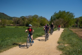
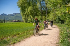
Route in Sant Pau de Segúries
We go to the north, the beautiful region of Ripollès. There the river Ter born and today we find in one of his early stages. The route that we propose the following lines is one of those that could be considered "nature" as follows roads and forests, but we will find surprises in terms of assets built by human hands. If you want to join, we are about to begin our steps. Starting point: San Pablo de Seguries.
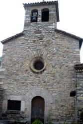
Perhaps some of you have often come to the lands of Ripollès, you may have crossed Sant Pau de Seguries by the C-151 road on several occasions, but never has apeteciso you stop and take a tour of this population over a thousand years of history. And it is very close to Sant Pau de Seguries many places of those who should be a must at one time or another in our life, such as Santa Maria de Ripoll, that of Sant Joan de las Abadeses, the iconic bridge and the streets of Camprodon, and picturesque villages such as Setcases, Molló, Beget...
 With this environment as high historic, scenic and heritage value, San Pablo de Seguries is presented discreet, as a place of passage. And we decided that at least we, today we will stop to see what's cooking. The proposed route passes outside-and I have said that would-nature, but fail to, sooner or later, to know the core of Sant Pau de Seguries, for example going to the square of the Age or the street, and its route Roman, linking the territory with Besalú, La Vall de Bianya and the Coll de Ares and is in very good condition.
As we have noted, to reach Sant Pau de Seguries should go get the C-151, which connects Ripoll to Camprodon Valley. By public transport, the city is well connected to major towns, among them Barcelona, Olot, Ripoll and Vic - thanks to the bus service offered by the company Teisa.
Ash
 The route will is indicated with yellow highlights and is suitable for the whole family. Just find a spot that we could call "critical". When we have to cross the river Ter If it rained hard recently and see that the river falls forward when you are there, you better swing and leave for another day what remains drive. Or return to the starting point and then start it in the opposite direction to the river, and we suggest that this is a circular route. What is the starting point? It is located next to the road, past Sant Pau de Seguries towards Camprodón, in a stretch where it makes a sharp bend and crosses the bridge Rovira. Leave your car at this place is a bad deal, there is little space, so We recommend to park in the village and go on foot. It is a time.
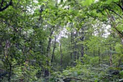
We walk down a path leading from the side of the bridge and along the river and find the first indications, with the reference Ral, a half hour away. We started full on a forest path and going Ter pulling the nose between vegetation occasionally. Information panels make it more pedagogical itinerary. The first panel tells the creative, shaping and destructive force of river currents, as this form beaches or what are guijarrales or gorges.
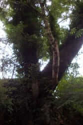
 Now that we know we can play and get them. Moreover, in some places there are banks, ie we can relax and browse by this route. Shortly walk we went to a flood plain, that is, formed by the accumulation of sediments carried by the river, with a rounded hill to the left of the landscape that will accompany us for the next steps, and beyond peak Costabona, with its 2464 meters of altitude. The also meet the more Peiro, with three arches on the balcony of his white facade. But do not look very far to find attractive: the foot road presents us a magnificent ash about twenty meters high and four meters in diameter and is estimated to have a century and a half old. As the accompanying sign says, was born about the time did Antoni Gaudí, and has survived wars of all kinds and booms of industrialization and tourism.
Ral
 More than centenary ash is one of the reasons why it is worth doing this tour, and how close we already have another. It is the small town of La Ral, in the middle of the plain, quiet, just a street with four houses on both sides and where it may appear that there is not a soul. Who would have thought that once had more activity Sant Pau de Seguries! It is located on the old road linking Ripoll to Camprodon, and few people can explain that its founder was Jaime I! Another historical fact vital to the Ral was the earthquake in 1428, cracking the houses that rose and church. The present church, Santa Maria de Gracia, dated 1609, and is among the people. The Ral care of a plain that is protected natural area with alder, meadows, beech and oak that make place of special interest and where a variety of wildlife lives.
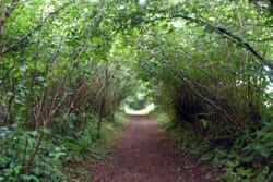 Leaving the fertile plains of La Ral we enter a true hazel tunnel that lead us, after passing through the plains of Can Falguera, direct to the river at the ford of Can Beia. This is the point we mentioned in the first lines: in principle is a good place to cross the Ter, but always with caution! On the other side we expect an asphalt road, but just be a moment, and we will take a detour to meet a curious and then the road returns to earth sanctuary.
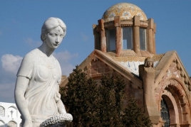
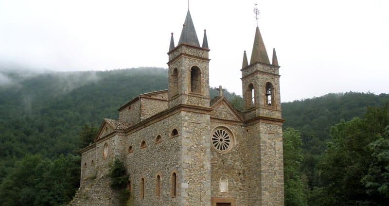
The Remei
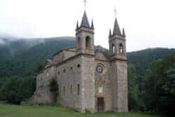 In a kilometer from the detour we are in the sanctuary of Remei, often also accompanied the "name" of Creixenturri, and that it is within the municipality of Camprodon. Surprised this great building in this lonely place, with two bell towers pointed at both sides of the facade and all with a stately air, we would say that not even Anglo Mediterranean. Information at the door of year was boosted in 1859 with plays directed by Antoni Masmitjà appears.
Religious worship in place, however, comes from old, from beyond the nineteenth century and in the X settled here Romanesque parish of San Cristobal de Creixenturri As in La Ral, earthquake nearly 600 years ago marked. a before and after, the parish surfed the consequences, and eventually a sanctuary for new plant was made.
 Every year on the second Sunday of October is held a meeting; a very good time to go, not only the environment but also aver that in autumn colors explode in the woods surrounding the Reme. However, when you go the scenery vayais not disappoint, with good views that can be seen looking Serra Cavallera.
Back out the way we had done to reach us the sanctuary and, once on the bypass, continue our journey, of course in the opposite direction from where we were to complete the circle. First we find the source of Teresa, with a trough, and immediately the house of rural tourism Can Peric.
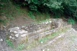
The stones that make light
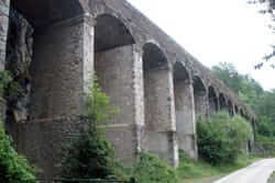 Fresh beech area where you are immersed makes us company on the last leg of this journey. But before closing, and almost back to the road, we find a couple of very close including findings. In fact, one behind the other. In the foreground, an aqueduct, which served to capture water from the Ter river and bring it down to a hydroelectric plant, producing electricity. Passing under the arches watched some large cuts in the rock of the mountain.
 Here was an old open pit mine carbide, a geological resource used as the light source. Onlookers observe folds in the rock are about 50 million years, and although now we may seem, have these forms because they were in coastal zone. We distinguish other clear debris and dark. The sheets are dark clays and plant and animal remains carried by rivers and accumulated in the sea at times of storms; clear sheets are carbonates, formed by the accumulation of skeletons of marine animals in quiet periods. When the Pyrenees were formed, these rocks rose and bowed, as we see today, and the organic material of the clay was transformed into a poor hydrocarbon used to make carbide.
Just the way where we had begun. It is difficult to say how long it takes to do it, because, as always, much depends on the pace to lead and times you want to be distracted, but Calculator reservaros a couple of hours, which I guarantee you will enjoy beautiful perhaps unknown landscapes for many in eastern Ripollès.
You may also be interested in: Guided tours of the towns and cities of Catalonia
What to do
GARROTXA amb Bici
Olot (a 13.5 Km)GARROTXA amb Bici, (previously known as "Centre Logístic de Bicicletes") is a…
Apartaments Entre Volcans
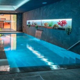
Olot (a 13.6 Km)Modern and well-located accommodation in Olot, with an indoor pool and spa…

Terra de Comtes i Abats a Sant Joan de les Abadesses
Sant Joan de les Abadesses (a 7.5 Km)Tierra de Comtes y Abats offers you a lot of proposals to…
Where to eat
Restaurant el Pont 9
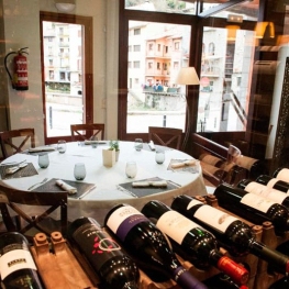
Camprodon (a 5.5 Km)A restaurant serving humble and simple cuisine, where you can enjoy the…
La Santa Restaurant
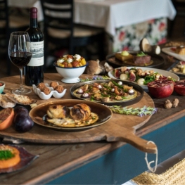
Ribes de Freser (a 17.6 Km)Our fires cook KM0 food obtained from the earth using traditional methods.…
Restaurant Dachs
Les Llosses (a 24.3 Km)Restaurant Dachs offers versatile spaces for celebrations in Les Llosses, with rustic…
Hostal la Muntanya
Castellar de n'Hug (a 28.8 Km)Family hostel located in Castellar de n'Hug. It offers various accommodation options,…
Where to sleep
Casa de colònies Mas Cabàlies, Fundesplai
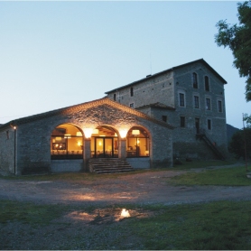
Ogassa (a 6.4 Km)Mas Cabàlies is located in the municipality of Ogassa, in the Ripollès…
Casa Etxalde
Camprodon (a 10.3 Km)Beautiful mansion built in the early twentieth century surrounded by green meadows…
El Serradal
Sant Joan de les Abadesses (a 11.2 Km)Relax in a natural setting of meadows and forests, enjoying walks, hikes,…
Hotel Cims de Camprodon
Camprodon (a 5.7 Km)The Hotel Cims Camprodon is located right in the center of Camprodon,…