Route through the Carena del Roc de Fraussa from the Sanctuary of Las Salinas
- Difficulty: Easy. No special difficulty. Some small climb to climb the Rocs de la Fraussa and El Contador.
- Unevenness: 594 m of accumulated positive unevenness.
- Time: total: 4h.
- Kilometers: 9 km.
- Variants: Another alternative to this route would be to do it on the French slope, following the GR-10 and including the Roque de Saint Sauveur ( Roque de San Salvador ) from Montalba ( Rosselló ). Another option on the Catalan side if you want more mileage and unevenness would be to start directly from Maçanet de Cabrenys. Both alternatives would exceed 1000 meters of positive slope.
Access
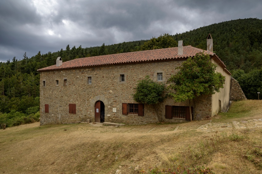
To get to the Salinas Sanctuary we must first go to Maçanet de Cabrenys. If we are coming from the south, we must take the AP-7 Figueres Nord (exit 3) and follow the N-II for 6.5 km until we reach the turnoff for Darnius and Maçanet de Cabrenys (GI-503 / C -769). We continue along this road, passing through arnius and we will follow it until the entrance to Maçanet de Cabrenys. Right at this point, we will see a street on the right with the indication of the Salinas Sanctuary and the Can Muntada urbanization. We continue along this street for a section until we reach a fork to the left and right. We take the street on the right, going up, towards the Santuario de les Salines (signposted). Now all we have to do is follow this track, which after about 3-4 kilometers is no longer paved and continues as a dirt road. In general, it is suitable for any tourism. We will go up gently making several pan curves. Shortly before reaching the sanctuary, we will avoid a cemented track to the left that goes directly up towards Moixer and Roc del Contador. We continue along the track to the right that flattens out to the plain in front of the Santuario de las Salinas.
Route
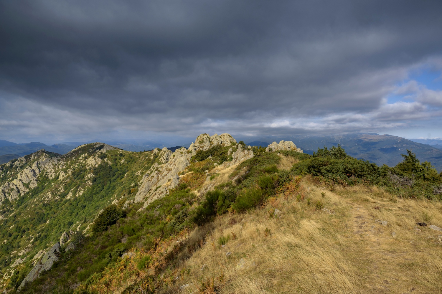
We start walking from the Salinas Sanctuary along the forest track that has led us here for a hundred meters. Just around a bend, we take a path that comes out on the right hand side indicated by the GR marks (link from GR-11 to GR-10) and the Route of the Tramuntana Refuges. We will have to go up a steep slope along the path in the middle of a very varied forest: we will find wild pine, chestnut trees, some ash and some wheat... in short, a diverse forest typical of the mountainous areas of the Alt Empordà
After overcoming this steep section, the path will come out at Coll dels Pous (or Coll dels Pous de Neu ), where we come across a cemented track that starts shortly before the Salinas Sanctuary and goes up to the Moixer antennas. We will not follow the track as it would be very monotonous and we would turn around, so we cross the Coll de Pous de Neu towards the French slope through a Canadian pass. The name of this pass is taken from the three old ice wells that were in the Comú de Maçanet and another that was in the Comú de Ceret. Currently only two are preserved.
Immediately after crossing the cattle pass, we turn left, heading west to begin the ascent towards Moixer through the beech forest. We leave the GR marks and follow the yellow stripes and also the signs for the Route of the Tramuntana Refuges. In fact, the GR-10 markings come out on a parallel path a few meters from Coll dels Pous and that is where we will return. Our path climbs strongly through the beech forest on the eastern slope of the mountain. The path is not to be missed (perhaps in autumn it blurs a bit with the fall of the leaves). Higher up, the path turns left (marked with yellow signs). If we continued straight on, we would continue through the beech forest on the northern slope of the mountain and along the GR-10.
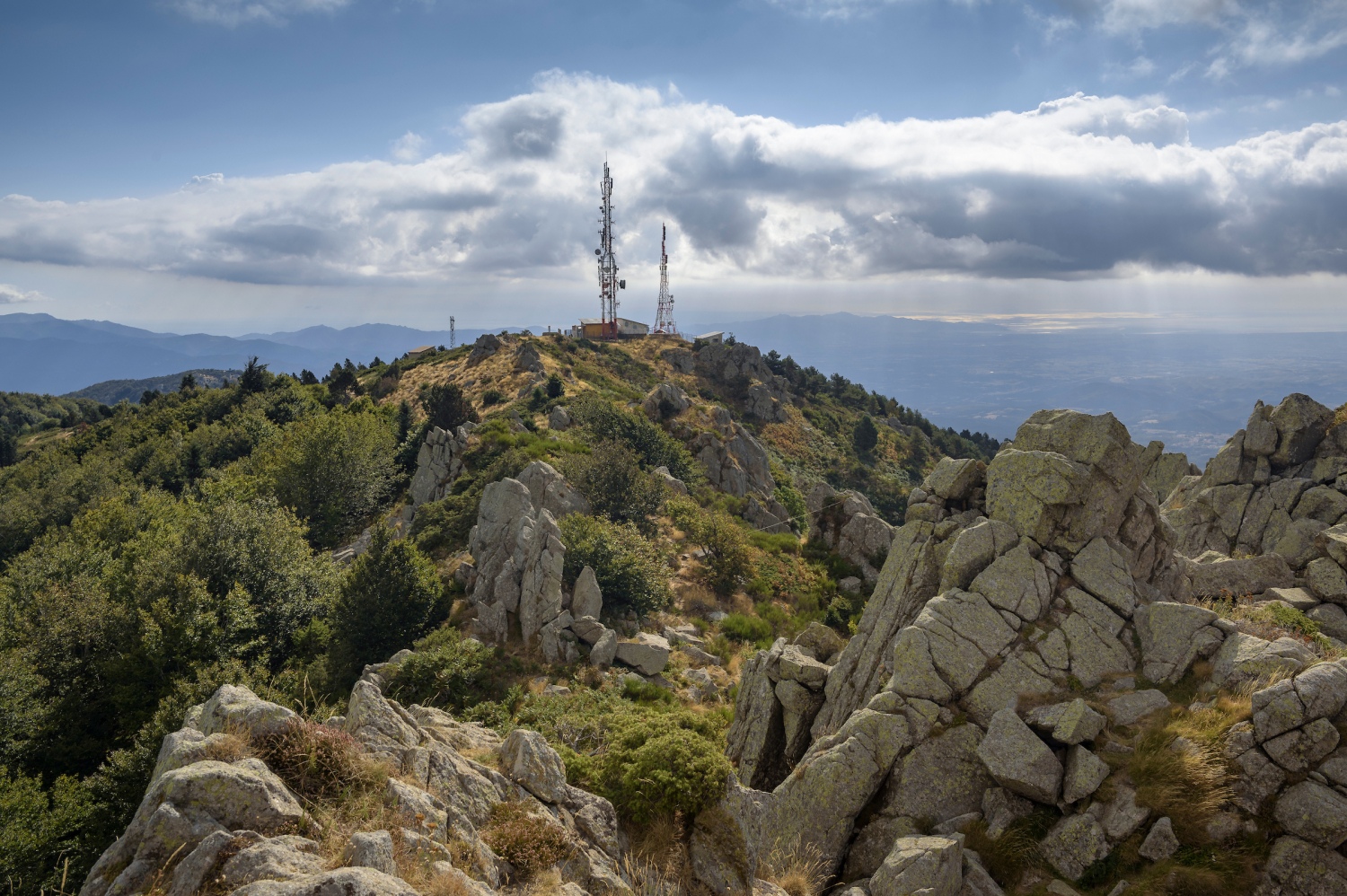
We continue climbing with a slightly less slope through the beech forest, almost parallel to the cow fence that we have on our left. Further up, we cross it by a pass that is open. Shortly after, a meadow opens up, the Raso del Moixer that crosses the Coll del Puig de la Neu. Before us we already see the Moixer antennas. We continue along the slightly trodden path that passes through the broom, ferns and other tall grass. Shortly after, we will find the cemented track that rises from below and we follow it for the last few meters to the Moixer, featuring the telecommunications antennas and various geodesic vertices. We also see a plaque that tells us that it is the Alt Empordà regional roof, although later we will see that the Roc del Contador is a few meters higher.
The view from the Moixer dominates the entire Alt Empordà and Roussillon. You can see the Gulf of Roses and Cabo de Creus perfectly. Also the peaks of Alta Garrotxa: El Mont, Puig Bassegoda and, further away, the antennas of Roca Corbatera. On the Roussillon side, apart from Perpignan and the plain, we can also perfectly see the Canigó Massif
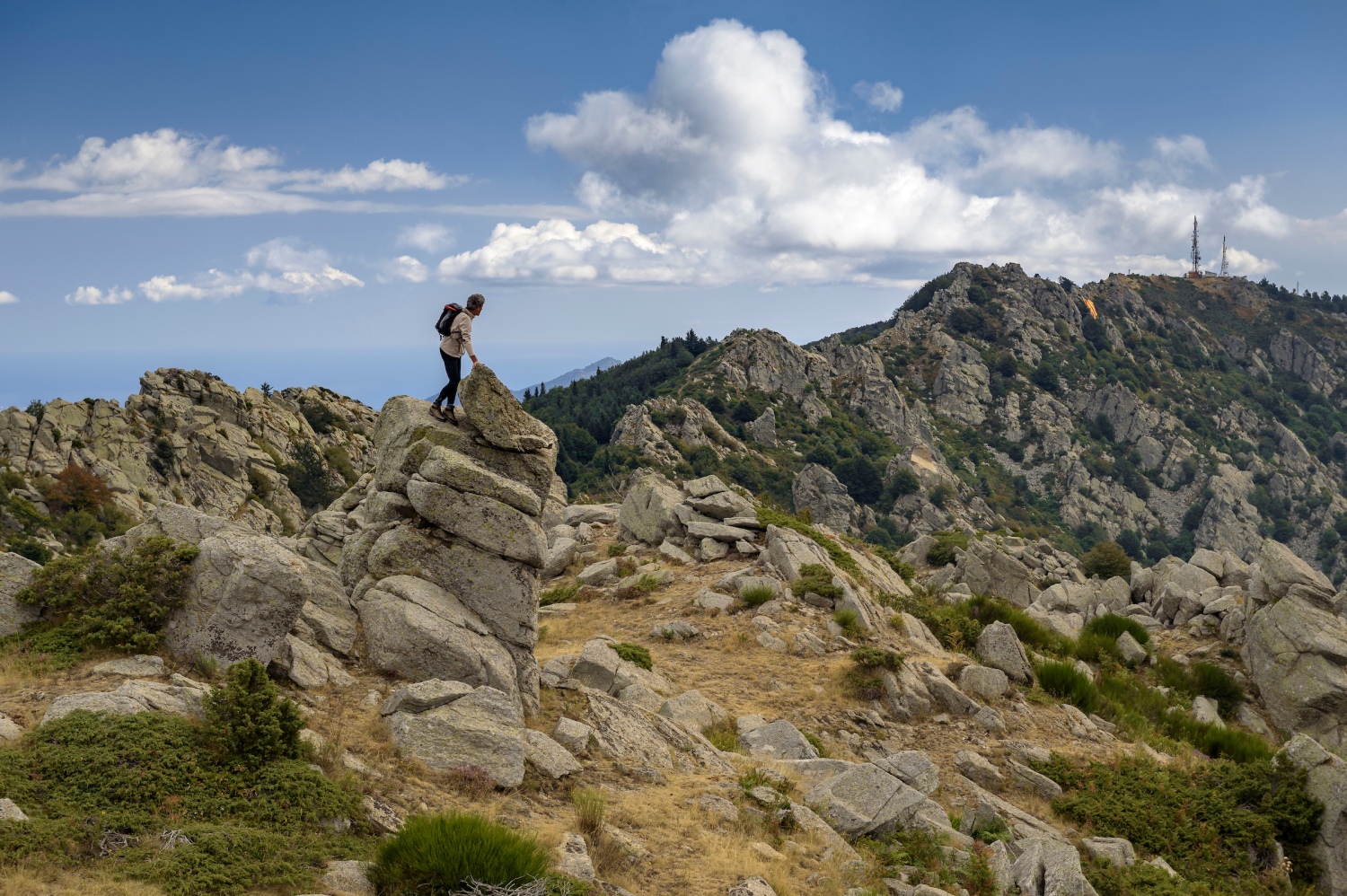
We continue along the Fraussa crest towards the next rocky promontory, the Roc del Contador. From the Moixer antennas it takes us less than ten minutes along the crest. We will be following the yellow marks that border it to the north (possibly we can still guess the old blue marks that were there). We will climb the last meters without markings, climbing the best steps between the granite blocks. The area has an air of Montseny, due to the type of forest and bare ridge with granite rocks in several places. At the top, a small cross and a wide view of the entire Fraussa ridge await us.
We unclimb these rocks to the path and continue along the path with yellow markings that descends along the northern corner of the ridge, to the foot of the Roc de la Fraussa or Frausa (we will even see Roc de França written at some point). Certainly, s It must say that there is some confusion between this peak and that of El Contador. Precisely in the Roc del Contador we find an inscription that says “ Roc de Frausa ”, so it is likely that you will find some map or indication with mistakes. Before reaching the authentic Roc de la Fraussa, we pass a little bit through a beech forest and alternate it with other open areas of broom and tall grass. Between the Roc del Contador and the Roc de la Fraussa it takes about 15 minutes. Right at the foot of the Roc de la Fraussa, we see an inscription on the rock in
We return to the path that borders the ridge to the north and continue going down a section along the path with yellow signs between some fir trees until we find the path where the GR-10 comes from. Later on, we will return along this path through the northern corner of the mountain, but before that we will finish reaching Roc de la Campana.
We pass the Coll de Sant Martí that opens into a clearing between the forest and also the views towards the south slope. We also found a small detour that would allow us to climb the rock in front of us. In this case, we avoid it and continue along the shady path, where the GR-10 passes and we enter the beech forest again. As we descend gently, we will find a double detour to the left: first with a red mark and the path that is not well-trodden, and then another, more well-trodden path with the sign for the Ruta de los Refugios de la Tramuntana. We will take the first slightly milled detour to the right and we will continue following the red markings until we come out of the forest and reach an area of meadows and bushes. We are in Les Collades and before us we see the rounded top of Roc de la Campana. To get there, we can choose to follow the red marks (which may seem to us to turn south, since they cross a small piece of beech forest), or continue along the ridge without a well-trodden path and tracing the best path until we reach the top. of the Rock of the Bell. If we choose the path with the red markings, we will cross a rocky area and a small section of beech forest and we will see an inscription on a rock “P6”.
From the rounded top, we gain a little more perspective towards the Alta Garrotxa sector, especially towards the Bassegoda sector, the Comanegra and, further away, even the Puigsacalm. The Canigó today remains hidden behind the clouds that cover the entire Vallespir.
It's time to return to the well-trodden path of the GR-10, passing through the grassy ridge or the path with red markings that borders a stretch to the south. Once we return to the GR-10, we will not leave it until Coll dels Pous. So, we avoid the path along the crest (the way we came) towards the Roc de la Fraussa and the Roc del Contador and continue along the path to the left that goes fully into the beech forest on the north slope. Just shortly after entering the beech forest, we take a short shortcut to avoid a GR-10 uprising. This shortcut, slightly milled, is indicated by red dotted markings and you will find the GR-10 a little further on. The section that we save, certainly, are a few meters, so you can follow both one path and the other.
The entire itinerary through the beech forest on the northern slope is one of the most beautiful and highly recommended sections of the route. The forest reminds us of other beech forests like those of Montseny, but with the difference of finding quite a few large trees... and another important difference: in these beech forests, we have found almost no one. We sign it up to return another year in the fall, when the colors must be spectacular.
After skirting the entire northern slope of Roc de la Fraussa, El Contador and El Moixer, little by little the path slopes towards the east. We will see how the beech forest is no longer so gloomy and we gradually descend to Coll dels Pous. Before we find a detour to the right that would go to find the way up. Finally, we go down to the Coll dels Pous where we cross again on the Catalan slope.
Before going back down to the Salinas Sanctuary, we will go up to the other side of the pass, to discover two more peaks: Roc del Pou and Las Salinas (or Puig de les Pedrisses ). We will go up a little between the ginestas and we will arrive at the foot of Roc del Pou. We deviate for a moment to the left to reach the top, from where we can perfectly see almost the entire Roussillon plain.
We return to the path and we now pass a little-trodden section and with somewhat high grass. We found grass of all kinds, ferns, some brambles and other plants. We even come across some yellow gentian, a typical plant of mountain environments. During this section, with the path a little bagged, we will find red dotted marks.
We arrive at a pass that according to the ICC is called Pas del Cavall and at this point we see a detour to the right. It is where we will go down to the Salinas Sanctuary. Now, however, we will face the last ascent to Puig de les Pedrisses or Roc de les Salines, along a more well-trodden path with yellow and red markings. Once up, we gain enough perspective towards the corner of La Jonquera, Puig Neulós and the entire coast of Empordà and Roussillon. We can also see, on the other side, the Moixer antennas and the beech forest on the north slope.
We undo the path to the descent hill and now we turn to our left along the path that goes directly down to the Santuario de las Salinas, indicated by yellow markings. The path loses height rapidly and enters a forest that is as diverse as on the ascent: with pines, ash trees, and several chestnut trees. Finally, the pine tree gains prominence from the rest of the trees and we face the last descent until we reach the plain of the Santuario de las Salinas. This is how we end this circular through the roofs of the Alt Empordà.
Authorship photographs and text: Sergi Boixader
You may also be interested in: Walking routes in Catalonia | Go hiking and get to know Catalonia on foot

What to do
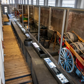
Espai Museístic Vi.Vent
Capmany (a 14.1 Km)The Vi.Vent Museum Space in Capmany is much more than an exhibition…
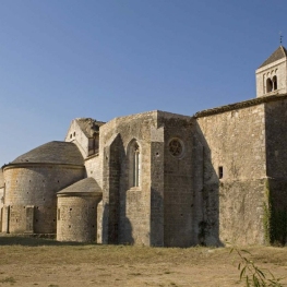
Canònica de Santa Maria de Vilabertran
Vilabertran (a 22.1 Km)Santa Maria de Vilabertran is, without a doubt, one of the best…
Where to sleep
Hostal Can Xicu
Capmany (a 13.9 Km)Can Xicu, restored in 2017, preserves the medieval feel of the house.…
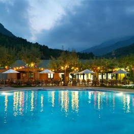

Càmping Bassegoda Park
Albanyà (a 9.7 Km)Enjoy the sky and the stars in a 1st category family campsite…
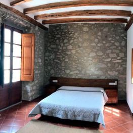
Allotjament Rural Casa Bàscara
Bàscara (a 28.5 Km)Disconnect and enjoy the tranquility and serenity offered by the Casa Bàscara…
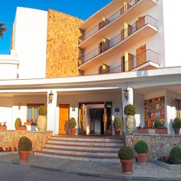
Hotel Empordà
Figueres (a 20.7 Km)Family-run hotel with 39 double rooms and 3 suites, featuring the El…