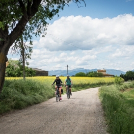
Greenways accessible to all

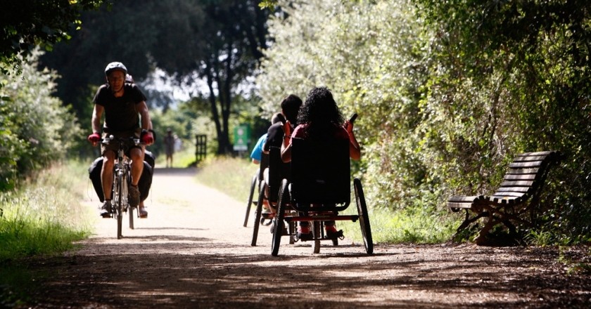
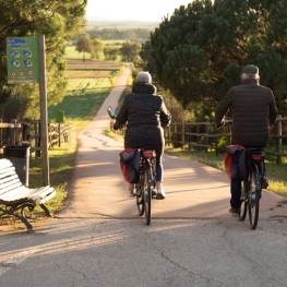
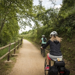
The greenways allow you to enjoy nature and tourism in a comfortable and attractive way and are currently adapted to access for all.
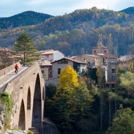
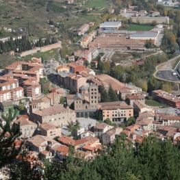
Most of these itineraries have their origin in the 19th century, when a railway network was created with the aim of connecting the different towns in the counties of Girona and the Costa Brava.
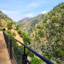
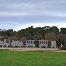
Today, these old railway infrastructures have become recognized cycling and hiking routes, and some of them guarantee accessibility for any user, facilitating their use for people in wheelchairs or also for blind or partially sighted people. In total there are 120 km of accessible routes that give us magnificent landscapes and places.
These autonomous communication routes have been developed respecting the environment and complying with the conditions of width, slopes and adequate surface quality to guarantee proper coexistence, safety and accessibility to all users, whatever their physical capacity.
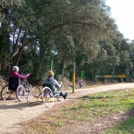
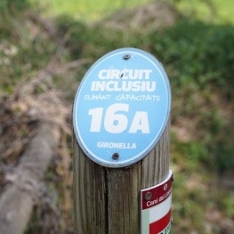
Another proof of this condition is the adaptation of various sections of greenways for people with visual disabilities. In these sections a base-guide has been installed to follow the route with the stick, and vertical signage with information in braille system.
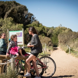
In addition, you can have adapted bicycles, including those of the handbike type, to pedal with your hands, and three models suitable for people with cerebral palsy or similar disabilities.
Enjoy the experience!
"Route of Ferro i del Carbó" from Ripoll to Sant…
The Iron and Coal Route, alluding to the important tradition of the forge in Baix Ripollès and the extraction of coal in the Ogassa mines, follows the route…
Accessible routes through Olot
On this route we propose a series of healthy itineraries to learn more about the city of Olot and its surroundings. In total there are six itineraries of low difficulty…
Petit Train Route, a greenway for the whole family
Route: Palamós - Palafrugell Start: Depending on the preferences of the users Route: Linear Distance: 6 km + 1km branch in Playa Castillo Difficulty: Low…
Inclusive circuit in Gironella
Beautiful, relaxing and inspiring tour. From the center of town we walk along the banks of the Llobregat river in its most beautiful part, the route is well signposted…
Route through the fields of Esclet in Cassà de la Selva
Difficulty level: Easy Total distance: 12km Starting point: Station The route through the fields of Esclet is a route marked by the light and the colors of the…
Circular route pedaling between cork oaks and hot springs
Route: Girona – Cassà de la Selva – Caldes de Malavella (return to Girona by train) Start: Girona Station End: Caldes de Malavella train station…
Green Round of Barcelona
In this case we tell you a circuit that is preferable to do by bicycle, since it takes advantage of several cycle lanes and the characteristics of its 72 km are…
Les Masies Greenway Route
The Les Masies route joins the municipalities of Vilablareix and Aiguaviva, and connects with Girona Airport, in the municipality of Vilobí de Onyar. Kilometers:…
Route of the Fountains and Verlets in Sant Joan les Fonts (accessible)
Sant Joan les Fonts is a municipality in the region of La Garrotxa formed by three population centers: La Canya, Begudà and Sant Joan les Fonts, which gives…
Route of Garrell de Argelaguer
Josep Pujiula i Vila (1937-2016) also known as the Garrell or the man of the cabins devoted much of his life to build and rebuild the Cabanes de Argelaguer. Next,…
Baix Ebre Greenway
The Greenway begins in the municipality of Tortosa, km 0, just where the old railway bridge that crosses the Ebro river ends . Large stones along with the remains…
Path through the Capçana lock in Cassà de la Selva
Difficulty level: Easy Overall distance: 5.9km Starting point: Station It is an ideal route to do with the family in the hottest months. The Capçana or Verneda…
Carrilet II adapted route: from Girona to Sant Feliu de Guíxols
With almost 40 kilometers in total and a constant gentle slope from Girona to Sant Feliu de Guíxols, the Ruta del Carrilet transports us from the capital…
Route of Carrilet II of Girona in Sant Feliu de Guíxols
The Ruta del Carrilet has a route of 41.9 km, with a gentle slope from Girona to Sant Feliu de Guíxols (15 m), and reaches the highest point in Cassà…
Circular route through the south of Gironès
Route: Girona - Quart - Llambilles - Cassà de la Selva - Sant Andreu Salou - Campllong - Fornells - Girona Start: Girona Route: Circular Distance: 37.5km…
Llobregat path
Long Distance Path (GR-270) that allows you to go from the source of the Llobregat river, in Castellar de n'Hug, to the mouth, in El Prat de Llobregat, passing…
Route through the Ripollès Greenways
Route: Campdevànol – Ripoll – San Juan de las Abadesas – San Pablo de Segúries Start: Campdevànol Church Square End: Sant…