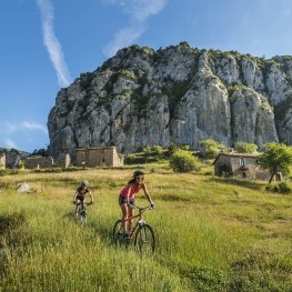
Route through Cap de la Boixassa through the Empedrats and return for the Adou del Bastareny
The calcareous terrain of Alt Berguedà has given rise to several springs of water that gush out in fountains and spectacular waterfalls. The most typical is in the Fuentes del Llobregat, but in the Bastareny valley, near Bagà, we find the main concentration of springs and waterfalls in the region: the Adou del Bastareny, the Bullidor de la Llet, the waterfall of the Empedrats and the Murcurols waterfall offer four jumpers with very different and original formations. This route links them all and also goes up to the Sant Jordi refuge and Cabo de la Boixassa to have a wide perspective of the Bastareny Valley from the heights. We recommend doing this route after a period of heavy rains, or in spring with the thaw.
- Difficulty: Medium.
- Unevenness: 1052 meters of accumulated rise.
- Time: Between 4h30' and 6h depending on pace and stops.
- Kilometers: 15.7 km.
- Variants: The four springs of the Bastareny valleys can be visited separately from the bottom of the valley. From Cal Cerdanyola we access the Bullidor de la Llet and the Empedrats waterfall in half an hour, and if we follow the forest track by car, we approach Adou and the Murcurols waterfall in a short time. Likewise, there is the possibility of following the route of the PR-125 all the time, which from the Pelosa pass goes down directly towards Cal Cerdanyola in a 10 km route.
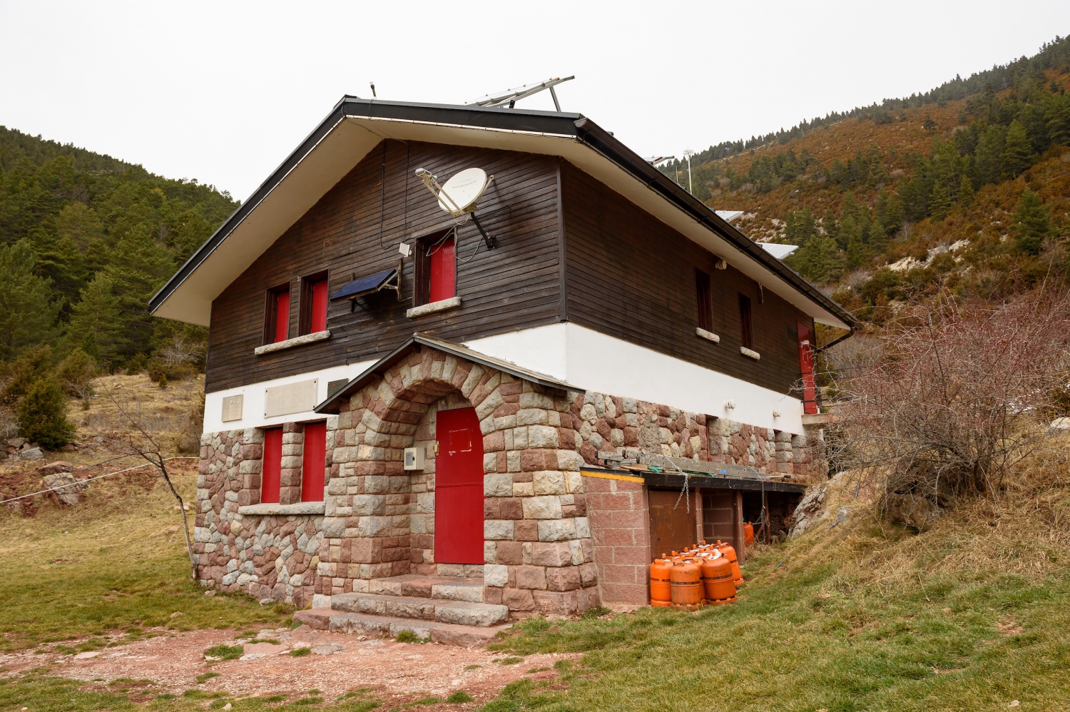
We left the car in the Cal Cerdanyola car park, a rural accommodation at the foot of the river and next to the Vents del Cadí refuge, a point through which the route of the Cavalls del Vent passes. It is normal for the car park to be full by mid-morning on weekends, so we may have to leave the car a little later.
We will start the route of the Empedrats following the PR-125 that comes out next to the bridge that crosses the river, to the right. We will continue along a path that follows the bottom of the valley in the middle of a Scots pine forest and with several sections of quite spectacular boxwood. The route is a classic in summer for those looking for a place to cool off, since we will be following the river all the time.
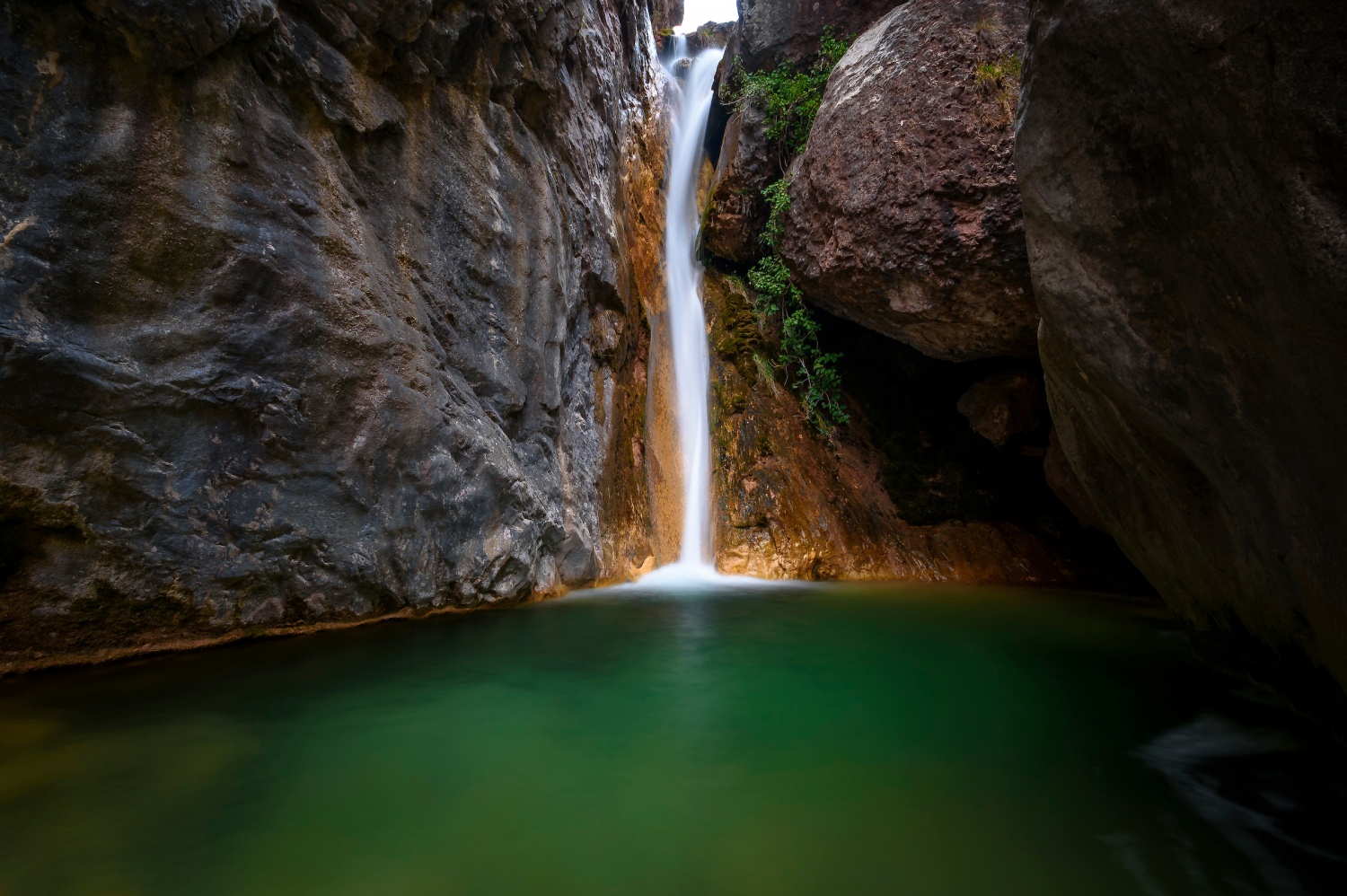
After about 15 minutes, we cross the river by a bridge and in a few minutes we arrive at the Bullidor de la Llet junction. We turn off along the path to the left that crosses the stream by a wooden lever and climbs a steep stretch of rock and a bojero to reach the Bullidor de la Llet spring. It is a natural spring that comes out through a fissure in the rock about 3 meters high. It is common for it to be dry if it has not rained for weeks or in periods of drought. Just below the jump, a spectacular rock channel is formed in which the torrent descends like a water "slide". In periods of abundant rains, this point is very spectacular and there is a small viewpoint to contemplate the water as it falls.
We undo the path to the detour where we left the PR-125 and return to the path of the Empedrats (precisely at this point is where we see that the original path was paved and hence the name, this was one of the most common routes to cross from Berguedà to La Cerdanya ). In a few minutes, the path thickens in the Strait of the Empedrats and we will have to cross the stream up to three times. If a lot of water goes down, we may have to get our feet wet at some point.
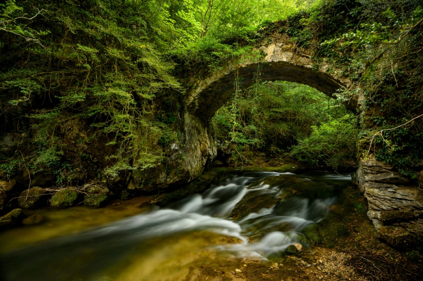
After this section, in less than a quarter of an hour we reach the Empedrats waterfall or the Cola de Cavall, a waterfall with a pool that in summer is a good place to cool off. We cross the Font del Faig torrent again and now we will go up on the right bank through a rocky area where we will have to be careful with the wet rocks if the water falls. Just above the big jump, we find other equally beautiful little jumpers.
We continue following the marks of the PR-125 and now we climb decisively while behind us are the walls of the Strait of the Empedrats. Further up we find a detour to the right, but we follow the PR marks, to the left.
We continue climbing, now more gently through an area of pines and boxwood, and we gain altitude with respect to the stream, on our right. Higher up, we cross it again and continue through a clearer forest area, with some beech trees, until we reach the Fuente Grande de Escribe (about 30-35 min from Los Empedrats ).
We continue, once again, along the left bank of the stream and in half an hour we arrive at the Sant Jordi refuge (1h30-1h40' from the beginning). The refuge is located in an area of meadows at the foot of the Moixeró mountain range. To the south, we can see the entire valley through which we have climbed, and upwards, we could cross towards Cerdanya through the Coll de Pendís, two hundred meters further up.
We opted to go up to Cabo de la Boixassa. For this reason, from the refuge, we undo the path until we find the indicator sign where we return to the PR-125 in a southwesterly direction. We go up through a black pine forest, we pass next to a fairly large cave and we arrive at a col from where we will see our objective. We continue along the foot of the ridges of Cabo de la Boixassa, and we cross several scree channels. We reach the crest through Pas de la Boixassa and discover that the sunny slope is completely covered by boxwood (hence the name of the summit). Now we will only need to go up the ridge by the easiest way to reach the top in a matter of a quarter of an hour.
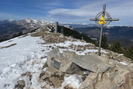
We reach Cabo de la Boixassa (1820 m, 2h 30' approx.) and contemplate the broad perspective to the south, the eastern slope of Cadí and Pedraforca. To go down, we undo the path to Pas de la Boixassa and continue down following the PR path that goes down the southern slope in the middle of the boxwoods.
In a short time we arrive at Coll de la Pelosa, a point where it can be accessed by a forest track. Now we only have to go down the forest track until we reach the bottom of the valley. We will see that after a while the PR-125 markings follow a path to the left: it is the fastest way to return to the point of origin, but to go to the Murcurols and Adou waterfall, the best way is to follow the track.
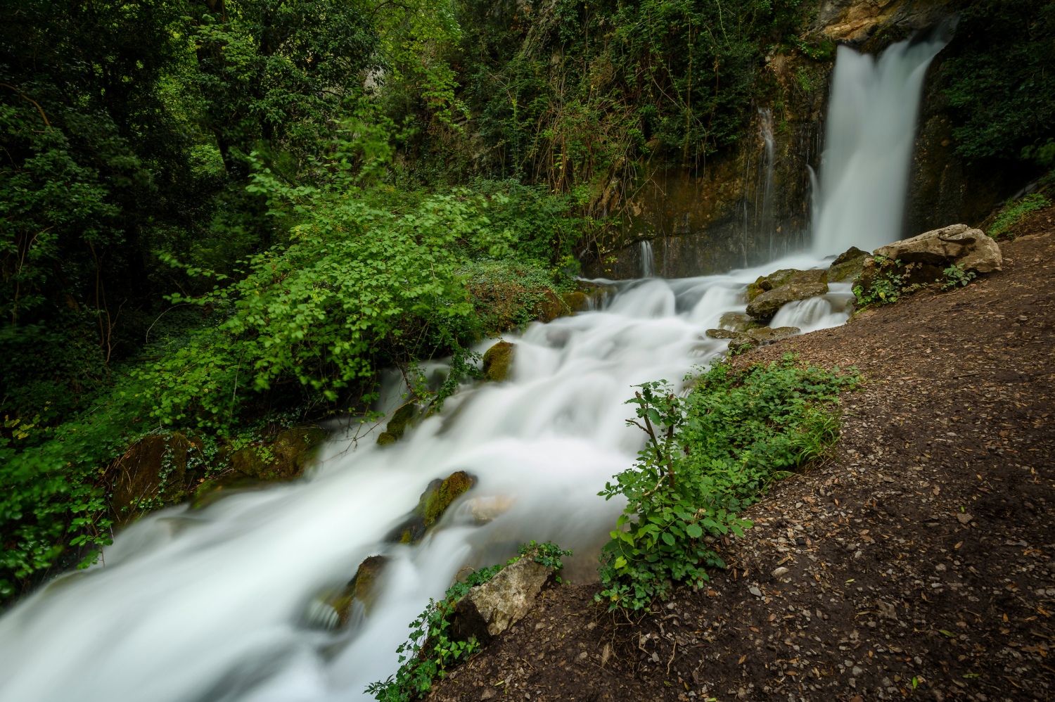
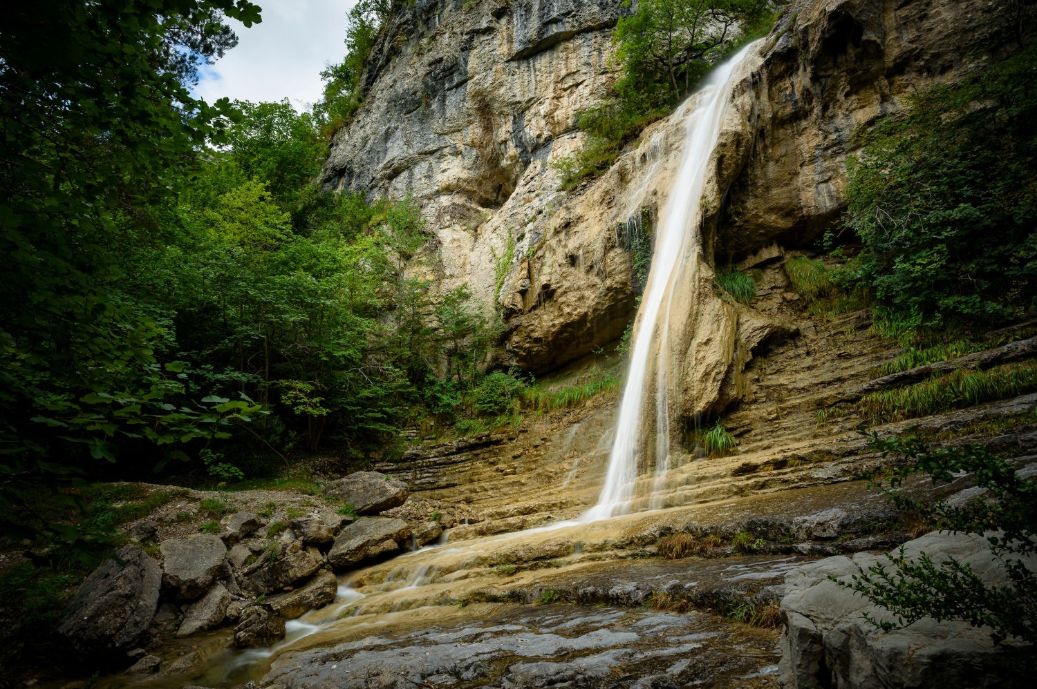
Going down, we can shorten the wide loops that the road makes, but we choose to go down gently following the forest track. After almost an hour downhill, we passed the Monnell house and reached the bottom of the valley. On the other side of the valley, we will see where the Murcurols stream flows down. To get to the waterfall, we will need to take a path to the right (local trail markings) that goes down until it crosses the Muga torrent and goes up a few meters until it reaches the foot of Salt de Murcurols (be careful not to deviate at a point where there are a fence on the other side of the stream, we must continue to the right).
In the Murcurols waterfall, the water has formed a curious, truly original stone slide. In summer it is common to find it dry, so it is best to go after a period of rain.
We undo the path to the forest track and gently go down the bottom of the valley until we reach the foot of the Adou del Bastareny after about 15-20 min. To get there, you will have to follow a very easy indicated path that passes next to the river. This is one of the most spectacular points on the route, as it is a natural spring that comes out of the rocks and collects a large part of the groundwater from the Sierra del Cadí. During the thaw and after the summer and autumn rains, it is the best time to feel the roar of water coming out of Adou.
We go back and continue along the forest track gliding gently. After 2 km more along the track and half an hour, we finally arrive at Cal Cerdanyola, the point of origin of this route.
Authorship photographs and text: Sergi Boixader
You may also be interested in: Go hiking and get to know Catalonia on foot | Walking routes in Catalonia
What to do

Centre d'interpretació Dinosaures Fumanya
Cercs (a 10.1 Km)Discover the Fumanya Dinosaurs Interpretation Center and travel to the past in…
Jardins Artigas
La Pobla de Lillet (a 9.2 Km)The Artigas Gardens, designed at the beginning of the 20th century by…
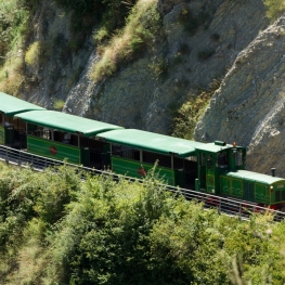
Tren del Ciment
La Pobla de Lillet (a 8.3 Km)Travel with the Tren del Ciment in a unique place where you…
Where to eat
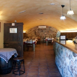
El Recó de l'Avi
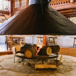
Guardiola de Berguedà (a 2.4 Km)Typical homemade cuisine, with oak-grilled meats, a wide variety of tapas and…
Hostal la Muntanya
Castellar de n'Hug (a 13 Km)Family hostel located in Castellar de n'Hug. It offers various accommodation options,…
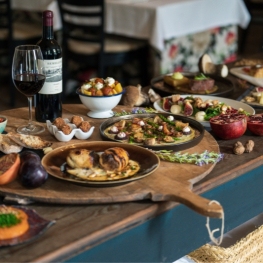
La Santa Restaurant
Ribes de Freser (a 24.3 Km)Our fires cook KM0 food obtained from the earth using traditional methods.…
Where to sleep
Hostal la Muntanya
Castellar de n'Hug (a 13 Km)Family hostel located in Castellar de n'Hug. It offers various accommodation options,…
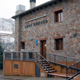
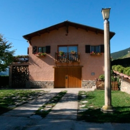
Hotel Casa Duaner
Guardiola de Berguedà (a 2.4 Km)The Casa Duaner Hotel in Guardiola de Berguedà offers modern facilities, a…
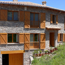
Restaurant Apartaments Els Roures
Castellar del Riu (a 16.3 Km)Rest, charm and good cuisine, a unique space located in Berguedà, at…