Route of the hermitages in Caldes de Malavella
An ideal route to go to the mountains and enjoy the religious architecture and nature of Caldes de Malavella.
It is a circular route that links different hermitages, churches and chapels, in a long but fairly flat route. At various points on this route we will find different links with other hiking and cycling routes.
It is a circular route that joins different hermitages in a long but fairly flat route. We start the itinerary in the Plaza del Ayuntamiento, where the Tourist Office is located. From here we go to the train station, a few meters before arriving we continue along Calle de Ponent that allows us to cross the track through a tunnel and find the first vertical signal (tracking flag) and the paint marks - yellow - that we They will guide the entire route.
The path continues along the paved road towards the Can Solà Gros urbanization, and then continues along a dirt road between forests and cultivated fields until reaching Franciac, where we find the Church of San Mateo de Franciac. At this point we share the path with the Via Augusta, which we will leave later to cross the train track and continue towards the church of Sant Andreu Salou.
 The route continues along the paved road, for approximately 2 km, where we find a main road that we must cross to follow the route along a forest track. We go into a wooded area along a very pleasant path until we find another main road, which we will also have to cross.
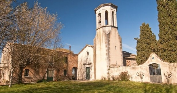
We continue the itinerary always following the yellow paint stripes, towards the Can Carbonell urbanization and we climb gently to the edge of the urbanization to find the Church of Santa Seclina, in poor condition.
From this point the route is shared with a section of the Camino de Terranegra (Caldes de Malavella - Tossa de Mar). We start going down and then plan until we leave the urbanization and by forest road we reach the C-35 highway. We cross it under a bridge and after making a gentle ascent along a forest track, the path takes us, now flat, along a section of the route between forest and cultivated fields to the Ermita de San Mauricio. We continue along the main track until a detour (directional flags).
We would return to Caldes along the track to the right, but we take the path to the left, a wide forest track that we will leave a few meters later. We continue along a section that alternates areas of forest and fields between scattered farmhouses. We crossed a stream and shortly after the train track. After a short stretch of road we arrive at the Chapel of San Sebastián, located in a private estate.
We return to Caldes, crossing the perimeter of the Lago del Cisne urbanization, we cross the road that gives access to the municipality and a few meters later we find the point where we have started the route, at the height of the bridge that allows us to pass the road and undo the road to the center of town.
All the routes make up more than 140km through the municipality of Caldes, in the La Selva plain; a situation that allows the coexistence of Mediterranean and central-European elements that give it a rare biological richness. First of all, we want to warn of the apparent monotony that the landscape as a whole offers us, at first glance. An impression that can be, and is, misleading.
Caldes, with a municipal area of 56 km2, has a large proportion of forests: oak, cork oak, holm oak and pine forests.
Source: Caldes de Malavella City Council
You may also be interested in: Know the religious heritage | Guided tours of the towns and cities of Catalonia

What to do
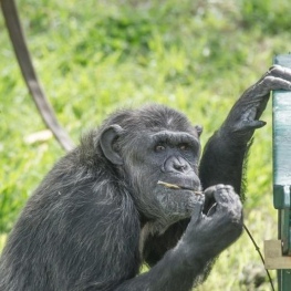
Fundació Mona
Riudellots de la Selva (a 6.6 Km)The Mona Foundation is a non-profit entity created to put an end…
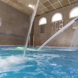
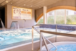
1881 Hotel Balneari Vichy Catalan
Caldes de MalavellaThe bicarbonated and sodium thermal waters of the Vichy Catalán Spring emerge…
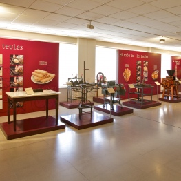
Museu Trias de la Galeta
Santa Coloma de Farners (a 11.5 Km)The Trias de la Galeta museum is the fruit of the Trias…
Where to eat

L'Espai Gastronomia
Tossa de Mar (a 16.7 Km)Enjoy a place where laughter, festivity, and gastronomy unfold around a large…
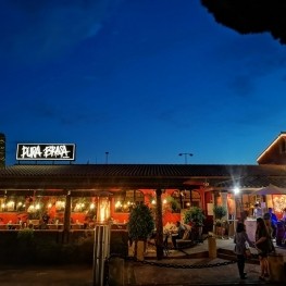
Pura Brasa
Pineda de Mar (a 25 Km)A unique gastronomic experience: Pura Brasa is a friendly and fun concept…
Where to sleep
1881 Hotel Balneari Vichy Catalan
Caldes de MalavellaThe bicarbonated and sodium thermal waters of the Vichy Catalán Spring emerge…
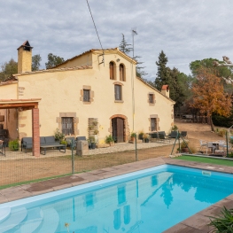
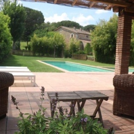
Can Baldiri
Santa Coloma de Farners (a 14.9 Km)Currently Can Baldiri is a home for tourist use by groups of…
Cal Rei Vinyes
Celrà (a 20.9 Km)Detached farmhouse ideal for groups on the outskirts of the town of…
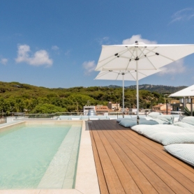

Neptuno Hotel & SPA
Calella (a 27.8 Km)Tradition and modernity merge with Mediterranean inspiration. We present our completely renovated…