Ruta de la Tourdera: from Hostalric to Malgrat de Mar
La Tourdera is a route to do on foot or by bicycle that runs along the river courses of the Tordera river and the Arbúcies stream, and that links the Mediterranean (Costa Brava and Costa Barcelona) with the Montseny Natural Park and Biosphere Reserve.
It proposes a journey through history, landscapes and people of a territory with surprising contrasts. Following the course of the Tordera and the stream of Arbúcies, we propose a route with its own personality, which can be done in different sections, which is at the same time a commitment to the territory and its people, a route to do on foot or by bicycle connecting the Montseny massif with the beaches of the Mediterranean.
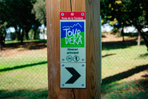
This section of the route links the towns of Hostalric and Malgrat de Mar, passing through Fogars de la Selva, Tordera and Palafolls. Remember that during the itinerary, you should not deviate from the signposted road and you should always respect the recommendations of safety and respect for nature.
Let's go there!
We will start the route in Hostalric, to go to Fogars de la Selva. It is an easy linear stretch of approximately 4.5 kilometers in length with a cumulative elevation difference of only 32 meters from the Tourist Office of Hostalric in which they circulated in a large part of the route on the side of the Tordera in a totally itinerary level, completely marked with road signposts.
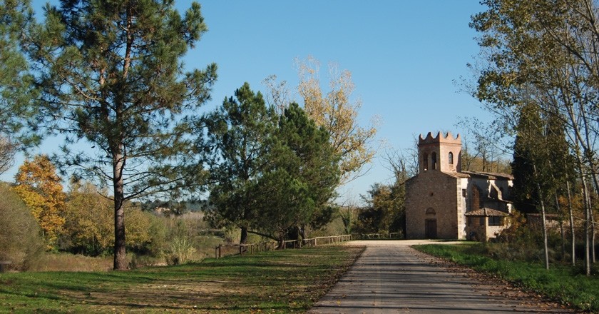
 This section is shared throughout its journey with walkers and bicycle users. Once you have arrived at the church of Sant Cebrià de Fogars, we will continue the route to the town of Tordera.
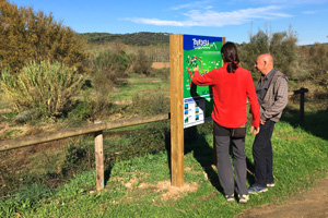
The route section of the Tourdera between Fogars de la Selva and Tordera is about 7.3 kilometers long, with an accumulated vertical drop of 64 meters and a general low difficulty. The start of the route takes place in front of the church of Sant Cebrià de Fogars, where you can leave the car and where you will find a tracking banner that will indicate the way forward from this point, as well as a panel with information of the Tourdera.
During the first 700 meters of route, you will enter the forest track through the Mediterranean forest of Cerro de Can Simó, the origin of the first population enclaves of Fogars.
This part of the itinerary, in fact, is the one that will mean saving a greater slope, since once you have passed the hill, you will take the old path of Fogars in Tordera, just parallel to the Parque de los Príncipes urbanization. When you reach this point, and through a vertical banner, you will see that you can divert to the Museum of the Peasant, which is approximately 1,400 meters and where you can see the recreation of a typical Catalan farmhouse and an exhibition of farm tools.
If you continue the route on the road to Tordera, for approximately one kilometer you can drive along a shoulder of land next to the paved road until the road and the paved road join together. It is, however, a low volume route of traffic. In the middle of this road you will pass by Pla de Julia where is Julia Lake, a small wet area included in the PEIN network.
At the end of the path of Fogars in Tordera, just at the confluence with the BV-5122 road, the itinerary takes a wooden walkway that connects with the river walk of the Tordera. From this point and to the town of Tordera, the route is completely segregated from traffic, in a walk along the side of the Tordera and where you will find some spaces with tables to rest.
Remember that if you go on a Sunday, you will find the Tordera market, known throughout and that attracts a large number of people every week. If you want to have good views of the Tordera, you can take the opportunity to climb the Puente de Hierro, a footbridge that is a symbol of Tordera and that is located at the end of the route, where you will find a panel of the route.
 In front of the Iron Bridge of Tordera, you can take advantage to have good views of the river. You have to take the southeast direction, following the indications of the first tracking flag towards Palafolls. For more than 2 kilometers you will be able to walk or pedal along the riverwalk of the Tordera, right next to the river, on a road completely segregated from traffic and very quiet.
When the tour ends, through a forest track, the route will continue and you will then go through the Puigverd industrial estate, which you can do along the sidewalk for safety. Once crossed the polygon, you get the Puigverd Mill, which currently hosts the non-profit private foundation El Molino de Puigverd. Now, you can enter the adjacent rainforest to take a short break.
Returning to the itinerary, you will head towards the Pla de Mas Tortòs, an agricultural area currently occupied by nurseries, which follows the forest track that will take you directly to Palafolls. From Palafolls, if you still have the strength, you can go to Palafolls Castle, separating from the 1,400-meter route, or visit the different unique Palafolls buildings.
We will follow the route to Malgrat de Mar taking the crossroads between Avda. Pau Casals and Avda. De la Ribera de la Burgada. Then you will connect with a bike path that will take you to the Tordera River Park, a space next to the Tordera River with two rafts, which will connect you directly with the path that is on the banks of the Tordera and that you will take towards Malgrat.
 Once passing under the GI-682 road (between Blanes and Palafolls), it will pass in front of the Palafolls Drinking Water Treatment Station and continue on the Tordera side to the Delta itself, in the Pla de Mas Bages. Specifically, once you cross the BV-6001 road, you will enter the municipality of Malgrat de Mar and, a few meters further on, you will see that the route enters a segregated road of traffic over the Tordera river.
If you continue straight, you get the ford of the Pla, a point where either continue straight to the mouth of the Tordera, or take the direction towards the village of regret by the path of Pla. At this point pay attention, since it is a paved road shared with traffic.
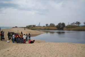
Throughout this section, you will walk among the orchards of the Tordera Delta until you reach the beaches of Malgrat, where you will once again find a segregated road from the traffic to the town, just behind the dune vegetation of the beaches.
You may also be interested in: Water and nature to enjoy with the five senses
What to do
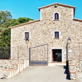
Museu de la Pagesia de Fogars de la Selva
Fogars de la Selva (a 1.5 Km)The Museum of the Peasant of Fogars de la Selva wants us…
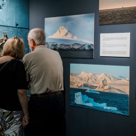
CG Gallery Lloret
Lloret de Mar (a 8.7 Km)CG Gallery Lloret is the first photo gallery of Cape Group. Our…
Where to eat
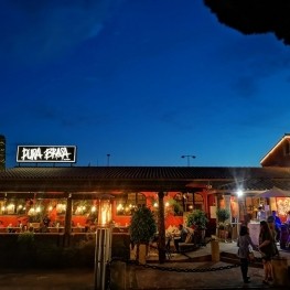
Pura Brasa
Pineda de Mar (a 4.2 Km)A unique gastronomic experience: Pura Brasa is a friendly and fun concept…

L'Espai Gastronomia
Tossa de Mar (a 16 Km)Enjoy a place where laughter, festivity, and gastronomy unfold around a large…
Where to sleep
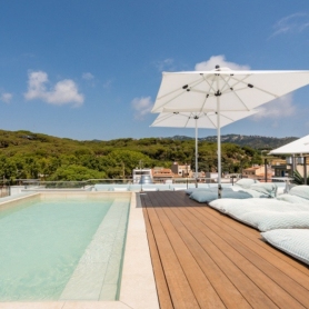
L'Azure Hotel
Lloret de Mar (a 8.5 Km)L'Azure is a new hotel designed for couples and families who want…

Neptuno Hotel & SPA
Calella (a 7.6 Km)Tradition and modernity merge with Mediterranean inspiration. We present our completely renovated…
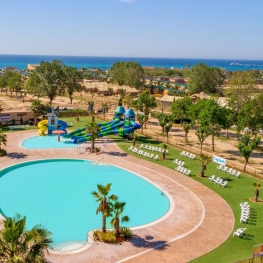
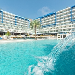
Camping Capfun Tordera-Nacions
Malgrat de Mar (a 2.7 Km)Camping Capfun Tordera-Nacions offers mobile homes and camping pitches, water sports facilities…
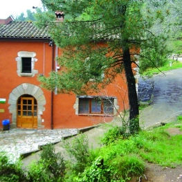
Casa de colònies Can Massaguer, Fundesplai
Sant Feliu de Buixalleu (a 8 Km)Discover Can Massaguer, an old restored farmhouse located in the middle of…