Les Masies de Roda


Among gentle hills and the meanders of the Ter River, the Masías de Roda stretch out like a mosaic of nature, historic farmhouses, and small towns that preserve the rural essence of Osona. Located just six kilometers from Vic, this town of about 700 inhabitants combines tradition, landscape, and quality of life in an environment that invites tranquility and discovery.
With an area of 16.38 km² and an altitude of 467 metres, the municipality almost completely surrounds the neighbouring municipality of Roda de Ter, with which it shares history and ancestral ties. It borders Santa María de Corcó to the north, Tavertet and Vilanova de Sau to the east, Tavèrnoles to the south, Gurb to the west and Manlleu to the northwest.
Les Masies de Roda offer visitors a unique combination of historical heritage, nature and rural identity, where each farmhouse tells a story and each path leads to a corner of peace.
A town of farmhouses and neighborhoods
The municipality takes its name from its very character: it is made up mainly of scattered farmhouses and four small population centres - les Cases Noves, la Esquerda, Fontanelles and el Vicenç - which account for nearly half of the inhabitants.
Les Cases Noves, with around 80 houses and about 200 residents, is where much of the town's daily activity takes place. La Esquerda, with around 20 homes, is a private neighborhood steeped in history, linked to the archaeological site of the same name. Fontanelles and Vicenç, more recently developed during the 20th century, maintain a peaceful, family-friendly atmosphere.
The rest of the population lives in farmhouses and isolated houses, authentic witnesses to the area's agricultural past. Among the most emblematic are Bac de Roda, Can Boixeda, Masdemunt, the Mosque, Mas de Salou, Puigcendre, and Serra dels Munts. Many of these farmhouses date back to the Middle Ages and have been restored respecting their traditional architecture.
This dispersed settlement has developed its own way of life, based on proximity to the land, community, and respect for the landscape.
Economic activity and rural life
The municipality's main activity remains agriculture and livestock farming, especially pig and cattle. The Ter River plays a fundamental role: it has shaped the terrain, fertilized the land, and determined the area's economic and social activities.
Industrial settlements such as Salou and Còdol Dret were built on its shores, now silent, but which during the 19th and much of the 20th centuries were economic drivers and centers of textile innovation. Even today, the remains of these settlements evoke a time of industrial ferment that transformed rural life.
The Ter has also shaped dry and irrigated agriculture, traditions, and even the way we understand time and landscape. Cereals, fodder, and potatoes are grown on the western plains, while the steeper terrain is dominated by oak, holm oak, and Scots pine forests.
This balance between agricultural activity, nature, and heritage has made Les Masies de Roda an example of rural harmony in the 21st century.
Natural environment and landscape
Las Masías de Roda is an ideal municipality for nature lovers and hikers. The landscape changes depending on the altitude and orientation: in the west, the land is flat and arable, while to the east, the terrain becomes rugged and spectacular, especially in the area of the Casserres meander formed by the Sau reservoir.
Here, downy oak groves, boxwoods, holm oaks, and riparian woodlands create a mosaic of intense greens and soft shadows. The paths along the river offer beautiful, panoramic views that combine the natural landscape with historical heritage.
The Guilleries-Savassona Natural Park and its proximity to the Sau reservoir make the town a privileged gateway to the natural area of the Alta Vall del Ter.
A history shared with Roda de Ter
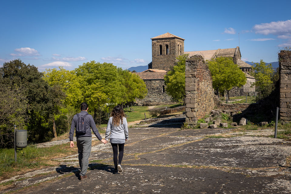
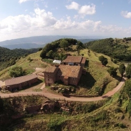
The history of the Masies de Roda is ancient and deep. Its origins date back to Iberian and medieval times, as evidenced by the archaeological site of La Esquerda, one of the most important in Osona. Situated on a cliff overlooking a bend in the Ter River, this settlement was occupied by Iberians, Romans, and later by medieval communities until the 15th century.
For centuries, the area was part of the town of Sant Pere de Roda, along with the urban center that is now Roda de Ter. Social and economic differences—between the rural nobility of the farmhouses and the industrial bourgeoisie of the urban center—led to the separation.
On July 15, 1805, following a mutual agreement, the municipality was formally divided into two separate entities: Roda de Ter and Les Masies de Roda. Since then, the municipality has celebrated this date every year with commemorative and cultural events that reinforce its unique identity.
More recent history has also left its mark. In 1978, the Parador de Turismo de Sau, within the municipality of Les Masies, hosted part of the drafting of the Statute of Autonomy of Catalonia, approved the following year. This event placed the municipality on the country's political map.
Places of interest
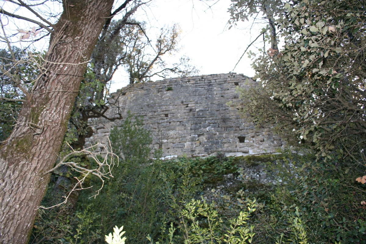
S'Avellana Castle
Documented since 1067, this ancient castle-fortress preserves remains of walls, a staircase, and the base of a tower. The walls cling to two large rocks joined by a plain above: both the rocks and the ground plan of the enclosure are elongated, like a ship with a pronounced spur to the east and a gentler angle to the west. Located behind Puig de Conangle, on a rocky edge very close to the River Ter, it offers spectacular views of the Plana de Vic and the Savassona forests. Access is on foot along the signposted path; it is not permitted to leave it or enter private property.
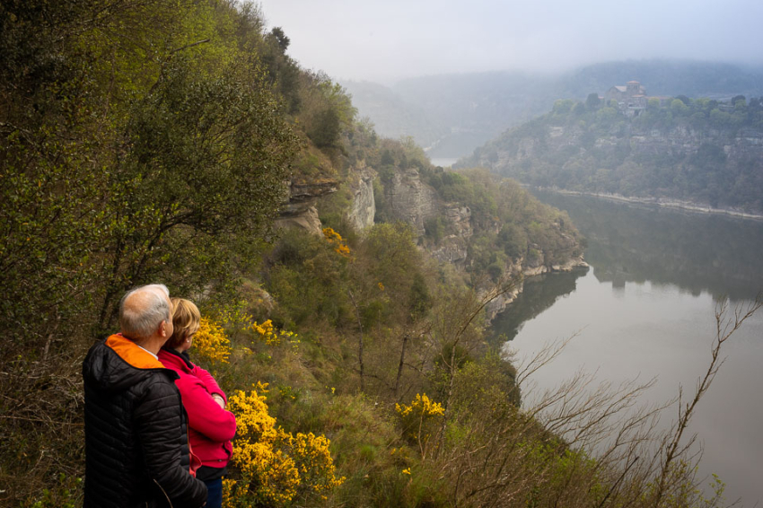
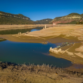
The Sau reservoir and the Casserres peninsula
In the Les Masies de Roda area, the Sau reservoir stretches from the western slope of the Esquerda peninsula to the eastern slope of the Casserres peninsula, where the municipal boundary is located. Within the Guilleries-Savassona Natural Area, visitors can discover a high level of biodiversity: cliffs, mixed forests, and a mix of Mediterranean and Eurosiberian vegetation that changes with the seasons. It is an ideal starting point for interpretive trails and panoramic views of water and rock.
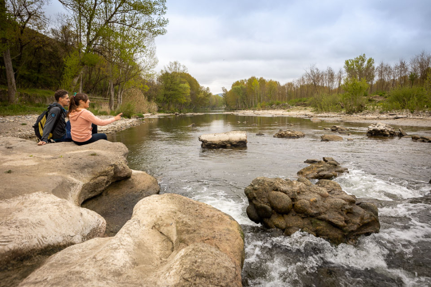
The Ter: the Gelabert meander
The River Ter shapes and gives character to the local landscape. Its tight meanders, such as that of the Gelabert, create a unique environment where riparian forests, poplars, cultivated fields, wells, locks, and the remains of old factories and colonies coexist. It is also a birdwatching area: you can observe the great cormorant, a wintering bird from northern and central Europe. The GR-210 Camí Vora Ter runs along the river and crosses the municipality: it is perfect for walking or cycling to enjoy the flora and fauna. This local section is part of the Ter Defense Group 's project, which links the Ojo de Ter with the Torroella de Montgrí Gorge.
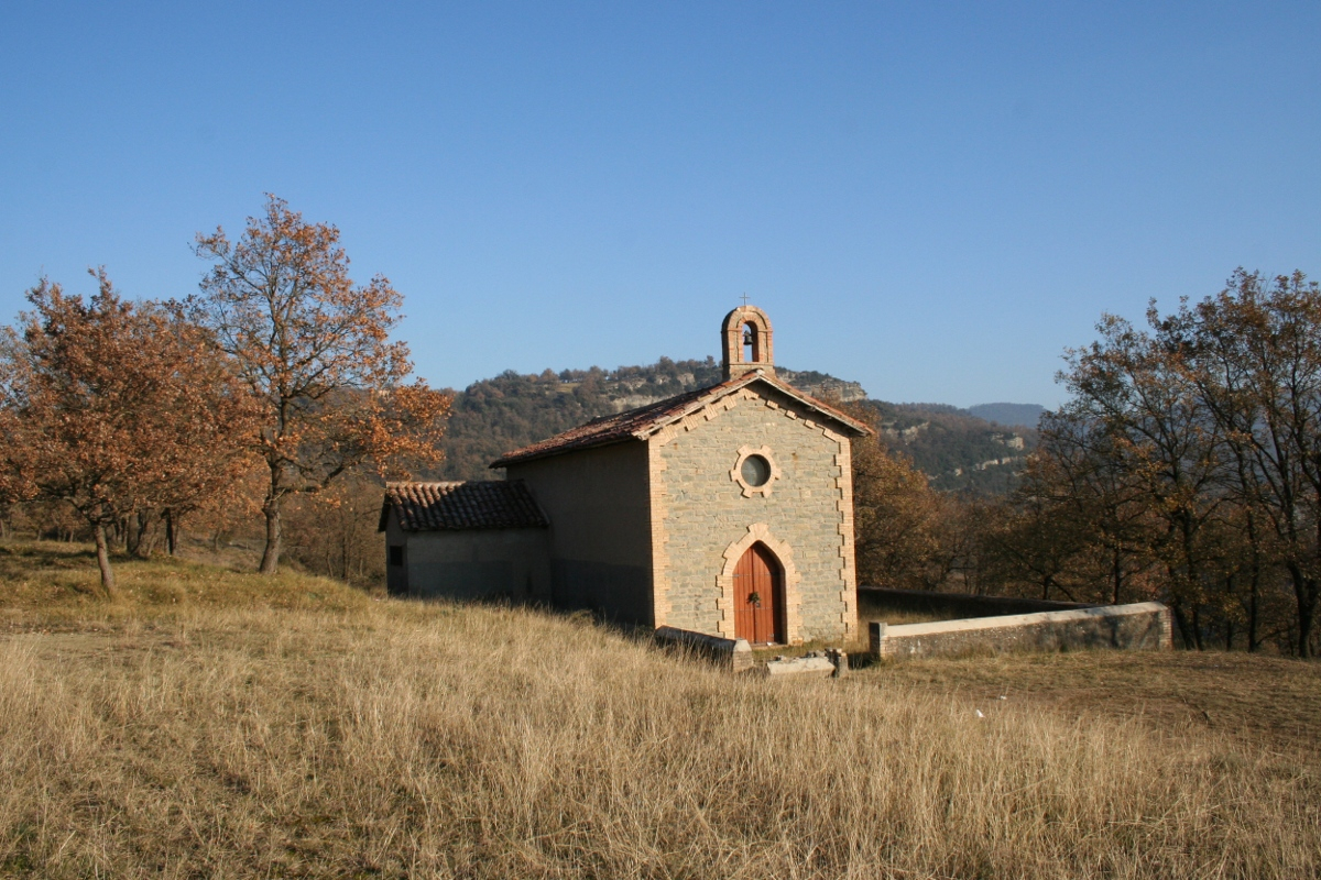
Hermitage of San Salvador de Horta
Linked to the old textile colony of Còdol Dret (1862–1964), now submerged under the waters of the Sau reservoir, this is the smallest religious building in the municipality (it seats about 40 people ). Built at the end of the 19th century, it was the colony's oratory and is still much loved by local residents: weddings, baptisms, and first communions were celebrated there. The hermitage is surrounded by a forest that, amidst varying water levels, offers a very beautiful and memorable landscape.
Hermitage of Santa Magdalena de Conángulo
Of Romanesque origin (around 1231 ), it has undergone modifications over the centuries. It served as a defensive castle, a monastery for Augustinian nuns, a sanctuary for hermits, and, according to tradition, a refuge for bandits. The site is rich in legends—regarding the well and the Holy Christ—which increase its appeal. It stands on a wide bend in the Ter River at an altitude of approximately 300 m, within a private estate in Salou. Access is possible on foot or by bicycle along the marked track; it is not permitted to leave the track or enter private areas.
Church of San Miguel de Guardia
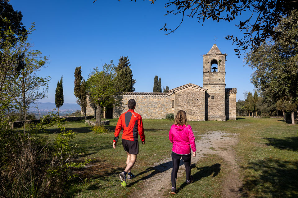
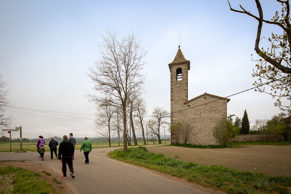
Documented since 1012, for centuries it was a small parish dependent on the Monastery of Saint Peter of Casserres, a fact that generated some conflicts. The current building is the result of a complete renovation in 1786, with no visible vestiges of the old temple. Today, canonically, it is dependent on the parish of Saint Peter. Located in the Vicenç neighborhood, it maintains its liturgical use and its value as a historical landmark of the municipality.
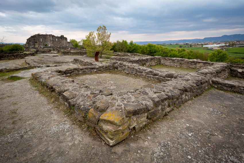
Archaeological site of the Esquerda
Perched on a cliff overlooking a bend in the Ter River, La Esquerda is an Iberian and medieval settlement with occupations dating back to the Late Bronze Age (8th-7th centuries BC) and continuing into the Middle Ages. Excavated since 1977, the complex provides an insight into the Iberian fortifications, streets, and workshops, as well as the church, cemetery, square, granary, and medieval blacksmiths. Guided and dramatized tours are offered, allowing visitors to travel back in time. Declared a Site of National Interest, it was chosen as a 2019 Catalan Favourite Monument.
La Bandera, the Còdol forest
It is the highest point in the municipality, crowned by a flag raised on an imposing flagpole. From here you get magnificent views of the Savassona forests, the Sau reservoir and Sant Pere de Casserres. Popular tradition calls for a walk around the Onze de Setembre mountain to change the flag. Around it are the forests that surrounded the old Còdol Dret colony (1862–1964), now under the waters of the reservoir, remnants of which can still be seen when the water level drops. In the area is the "Comarca" climbing area, considered one of the best bouldering areas in central Catalonia.
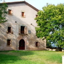
Monastery of Saint Peter of Casserres
The only Benedictine monastery in Osona and one of the most exceptional examples of Catalan Romanesque architecture (11th century). It is the only monument in the country that maintains its original structure from that century. Promoted by Viscountess Ermetruit (who acquired the land to build it in 1006 ), the monastery presides over one of the last meanders of the Ter River before the Sau reservoir. The permanent exhibition interprets monastic life through recreations of rooms, audiovisuals, and legends. Guided tours provide an insight into the daily lives of the monks and the history of this unique site.
Nearby routes
See all routes »- The Vigatans' Covenant
- Miquel Martí i Pol literary route (a 1.1 km)
- Route of the Iberians Ausetans (a 1.1 km)
- Route of trades in Electric Car through… (a 3.1 km)
- Grand Tour de Catalunya - Section 5.… (a 3.1 km)
What to do
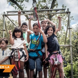

Parc d’Aventura Anigami
L’Esquirol (a 7.9 Km)The Anigami Adventure Park at Mas Les Comes de l'Esquirol is a…
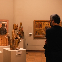
MEV, Museu d'Art Medieval
Vic (a 8.6 Km)Conferences, guided tours, thematic tours, workshops, courses... Discover the permanent collections and…
Where to eat
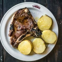
Braseria Les Comes
L’Esquirol (a 7.9 Km)Located on the premises of the Anigami Adventure Park, they offer menus…
Restaurant Dachs
Les Llosses (a 24.6 Km)Restaurant Dachs offers versatile spaces for celebrations in Les Llosses, with rustic…
La Calma, el Bellver
Tagamanent (a 26.6 Km)At the Masía Restaurante El Bellver, from 1:00 p.m. to 3:30 p.m.,…
Where to sleep
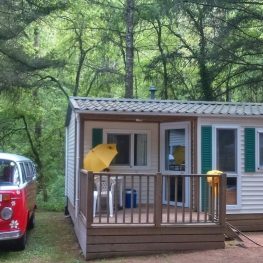
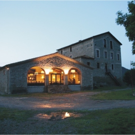
Càmping El Pont de Barcelona
Vilanova de Sau (a 10 Km)The El Pont campsite is located in the heart of the Guilleries…
Casa de colònies El Company, Fundesplai
Vilanova de Sau (a 7.5 Km)Discover the El Company hostel, in the municipality of Vilanova de Sau,…
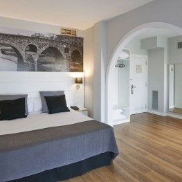
Hotel Can Pamplona
Vic (a 9.4 Km)Hoel Can Pamplona is a family-run Bed & Breakfast located just steps…
Casa de colònies Els Porxos, Fundesplai
Vilanova de Sau (a 7.3 Km)Els Porxos is located in the Vilanova de Sau municipality. It is…
Events

Experiences
Masterpieces from the Museum: A Journey Through Medieval Art…
MEV, Museu d'Art Medieval (Vic) (a 8.6 Km)