The Cucurull route through the Coll de Revision in Roda de Berá
Do you know the Coll de Revision in Roda de Berá? We propose a route around the municipality where you will enjoy spectacular views.
From the Plaza de la Sardana the corrales de Cal Guivernau
We left the Plaza de la Sardana, crossed the Plaza de los Pinos and reached the road, on the street of the flowers. We turn left through the old town hall building (today Hotel de Entidades), we go through the church square and go up the street on the right that borders Hay Guivernau, which was the seat of the old elementary schools of the town and where some theories of the castle of Roda de Bará are located.
We pass through the Plaza de a Todos los Caídos and continue down the descent of the Nuns, leaving Elías, which was the seat of a nunnery, on the right and hence the name of the building. On the left we leave the access to Ca l'Olivar, one of the old manor houses of the town, where the Cultural Association "Las Monjas" is currently located.
We continue down to the Landing and turn right along the stream arriving at the street of the water. We passed by ca la Martorella (nowadays cocktail bar) that combines respect for the original construction with a creative and modern interior decoration.
We cross under the railway bridge and leave the town along the Cal Lorenzo path, towards the bottom of the same name, along a wide concrete path, following a high wall that protects the fields located at the highest elevation. As we walk, two water ditches accompany us to the right, at the top of the wall. One led the water to the town from the Fuente del Común and the other led it to the RENFE rafts, using steam locomotives. Next to a light tower, before reaching the new AVE bridge, we can see the manhole where the ditches diverge and from which the flow of water to one or the other was controlled.
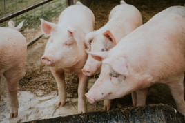
We cross under the AVE bridge and pass an old pig farm on the left. A small pine forest and the silhouette of the corrals of the Cal Guivernau farmhouse, are points that warn us that we will soon find the sign to turn left, separating us from the yellow route with which we have walked so far and that continues straight on towards the Xim's flat.
From the Corrales de Cal Guivernau to the Balcón del Mediterráneo
The path becomes narrower, stony and goes up a bit. Just start, on the left, we find a small stone well.
As we continue along this path, which was where Bonastre used to be reached (before they made the road), we will find the only native palm that is behind the path. We reach the first peak where we find the steepest climb on this route. From the top we can see Bonastre, its new road, its greenhouses and on the horizon, the Montmell mountains "The roof of the Penedès".
We are walking along the sidewalk of the ridge, with views to the left of the bottom of Cal Lorenzo, the new and old farmhouses of the same name and Rueda in an increasingly wide view that reaches the sea. To the right there is Creixell and its castle and especially its church of which Jujol made the top of the bell tower, Torredembarra and its lighthouse, La Pobla de Montornès and Altafulla.
We crown the third elevation and here we see remains of an old trench, the AVE track on both sides of the mountain and we pass over the tunnel excavated in the Flaresso mountain.
From here, on clear days, you can clearly see Tarragona Cathedral and Cap de Salou.
From the Mediterranean balcony to the Cucurull
After the break, we continue climbing to the top of the Flaresso mountain, from where you can see one of the best views of Roda.
We walk until we find a sign indicating the Cueva del Buen Juan and the Sima del Flaresso. To visit them it is necessary to depart from the route and it is not convenient to do it with people who are not well prepared to walk in the mountains. Both are about ten minutes from the signage.
To the right, the Cueva del Buen Juan. We go down the narrow path that starts from the sign and is located on a mound immediately below, on the side that faces the immediately lower mound, on the side that faces the sea. This cave, with a wide and well protected entrance, is believed to have served as a workshop for the construction of utensils, due to the prehistoric remains that have been found.
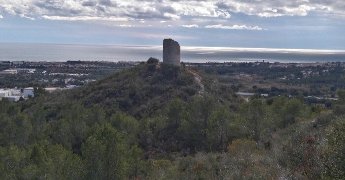
On the left, the Sima del Flaresso, located at the height of the AVE tunnel. It has a shallow vertical entrance and then there are beautiful galleries with stalactites and stalagmites. From the Flaresso mountain you can already see the Cucurull. To get there, we go down a narrow and stony path to Cucurull, a watchtower for some and the remains of a castle for others. It is a round tower built in the mid-eleventh century based on unworked stones of different sizes and joined by lime mortar. Part of the base and the first floor are preserved but there are no remains of the entrance door that had to be at the base.
Del Cucurull in the Plaza de la Sardana
We also see the new industrial park of Avenar and the last water tank. We descend in a comfortable and pleasant way with the view of Roda and the sea.
We go through the crossroads of trails that lead to the station rafts and the signs that lead to the flour mills that were built at the end of the 18th century. They were hydraulic mills and the water they used came from Bonastre through a ditch that ran through a tunnel dug in the rock of Coll del Repaso. The rafts are kept in very good condition and the mill workshop below as well. The upper millworkers are partly carved out of the rock, but today they are in ruins.
We turn right passing by the side of the old Prats farmhouse, now converted into the Los Molinos rural house. Following the canal, we arrive at the first water tank in the town, which looks like a gigantic test, due to the amount of vegetation that crowns it. From here we go to the orchards and when we reach the end we find a closed behind which is the old laundry of the dead, where the clothes of the people who died were washed.
We turn left to cross the last orchards, along a path next to the irrigation canal. We continue to the right and go under the train bridge until we reach the fountain where the washhouses were located.
Source: Town Hall of Roda de Berà
What to do
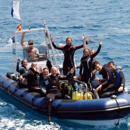
OdySea - Centre de Busseig - Diving Center
Torredembarra (a 7.1 Km)Spend a fun day with us getting to know the aquatic world!…
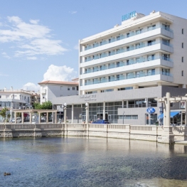
Hotel Balneari Platja de Comarruga
El Vendrell (a 5.7 Km)Spectacular resort located near the sea to enjoy the marine environment and…
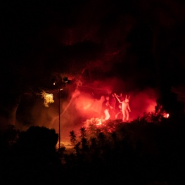
Pessebre Vivent Pobla de Montornès
La Pobla de Montornès (a 3.8 Km)A living manger is the representation of the birth of Jesus of…
Where to eat
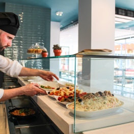
Arena Tapas Restaurant
Salou (a 29.6 Km)Enjoy an innovative cuisine, with high-quality local products of proximity, with an…
Where to sleep
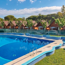
Càmping Arc de Barà
Roda de Berà (a 1.9 Km)Arc de Barà is a very family-friendly campsite 60 meters from the…
Càmping Trillas Spa Tamarit
Tarragona (a 10.1 Km)Its peaceful location, between the sea and the mountains, surrounded by various…
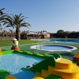
Camping Capfun Alba
Creixell (a 3 Km)Located on the Costa Daurada, 150m from the beaches, the Capfun Alba…
Hotel Balneari Platja de Comarruga
El Vendrell (a 5.7 Km)Spectacular resort located near the sea to enjoy the marine environment and…