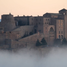
Route of the Trenches in Castellfollit de Riubregós
Interesting itinerary around Castellfollit de Riubregós, a territory with a lot of history, part of which we will know walking. Legacies from the medieval era will only come as we will see, but the Spanish Civil War has also left witnesses not so much visible but very real.
The route is short, a demanding point in some sections and diverse in themes.
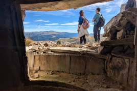
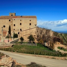
We will have wide panoramic views that reach the Pyrenees as well as the Llobregós river valley, a strategic enclave to control access to La Segarra and El Solsonès.
In borderlands and castles
The lines of defense L1, L2, L3 and L4 that the Republican Army organized from east to west against the Francoist advance lasted a short time after the enemy crossed the Ebro river.
Castellfollit de Riubregós was part of the L3 defense line , and witnessed the confrontation between the two sides, on the 21st and especially on the 22nd of January, 1939.
We will leave the south west of the Castellfollit de Riubregós nucleus, where according to oral testimonies in the south east there were some anti-aircraft shelters, currently sunken.
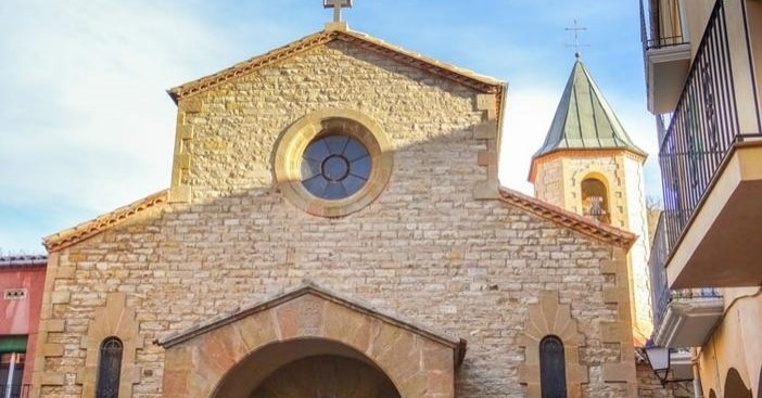
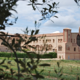
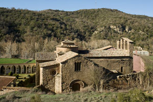 We will pass through the Priorat de Santa María (11th century), where outside the cemetery there is a mass grave, possibly of republican soldiers killed in Castellfollit de Riubregós.
We will go on the right side of the enclosure to a path that goes to the right and we will go up gently along the Costa de Balaguer following the direction of the valley for about 500 meters until we reach the Cal Dé thrashing, currently in very poor condition.
We will change direction and we will go again towards the town, we will go up the Costa de Balaguer, crossing cultivation terraces until we reach a line of trenches, there is little left but they are still noticeable.
We will advance doing a bit of cross country through a maquia of kermes, brambles and other hard plants like the ground we will tread on, it has scratches.
It is a stretch of about 500 meters uncomfortable to step on, but we will see aerial views of the priory, the river, the bridge, the town, the castle and the defense towers, then we will arrive at General Mina's cabin.
From this point on, the path becomes smooth again, easy and will take us to a dirt track that we will no longer leave and that will take us to the old cement and plaster factory of the UMSA company , with some kilns and industrial chimneys. very interesting.
Will we close the circle after walking about 400? Meters and cross the riverbed by a wide walkway.
Source: Castellfollit de Riubregós Town Council
You may also be interested in: Walking routes in Catalonia | Go hiking and get to know Catalonia on foot
What to do
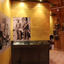
Memorial de l'Exèrcit popular
Pujalt (a 6.9 Km)The People's Army Memorial in Pujalt invites you to discover the history…

Solsona Experience, descobreix el Solsonès
Solsona (a 25.2 Km)Experiential guided tours of the Solsonès region for all audiences, groups and…
Mas de Colom, Casa Borges
Tàrrega (a 28.9 Km)The former convent and farmhouse are located on the Mas de Colom…
Where to eat
Hostal de Pinós
Pinós (a 10.2 Km)It is the oldest restaurant in Catalonia that has never closed its…
Where to sleep
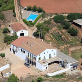
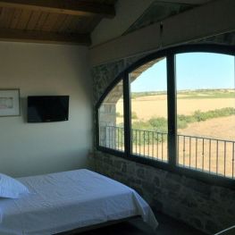
Les Corts de Biosca
Sant Mateu de Bages (a 14.6 Km)A well-equipped, comfortable agritourism property with splendid views, just an hour from…
Masia Mas Set-Rengs
Sant Salvador de Guardiola (a 27.6 Km)Discover Mas Set-Rengs and enjoy a farmhouse located in a privileged natural…
La Torre del Codina
Tàrrega (a 27.2 Km)The Torre del Codina is located in the municipality of Talladell, municipality…

Hotel La Freixera
Solsona (a 25.2 Km)Discover Hotel la Freixera, a charming boutique hotel located in the middle…