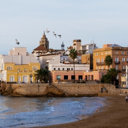
La Morella from Garraf beach
La Morella is the culminating point of this calcareous massif on the Catalan coast. Despite being a summit of modest height and surrounded by a fairly barren landscape that has been transformed by humans, it enjoys a great deal of solitude and tranquility a few kilometers from the big city. To this summit we add the incentive of starting from level 0, next to the sea on the Garraf coast. In this way, all the unevenness that we make up to the top will be an effective unevenness.
We start in the coastal town of Garraf, next to Celler Güell, a modernist work by Gaudí. We pass next to the access road to this nucleus until the Garraf coast road (C-31). We cross it and take a small path that goes off to the left and is marked with GR marks. This is the GR-92, the long-distance trail that follows the entire Mediterranean coast of Catalonia. Throughout today's route we will follow the marks of this GR to the top of Morella. At some points we will also see a green mark and signposts for the Macizo del Garraf Natural Park.
The trail begins flat out a short distance from the coast road. We will pass next to a path that would take us to the road (it will be another option to leave the car and start from here). The road climbs gently, first in an easterly direction. After a while, at a small viewpoint, we take a path that goes to our left, heading Northwest. From this viewpoint we will have a magnificent view of the town of Garraf and the coastline that goes towards Castelldefels.
The road winds through stone pine forest and typical Mediterranean vegetation: Kermes oak, rosemary and other bushes typical of this landscape. We will also be able to appreciate some hearts of palm, the only type of native palm tree in the Mediterranean.
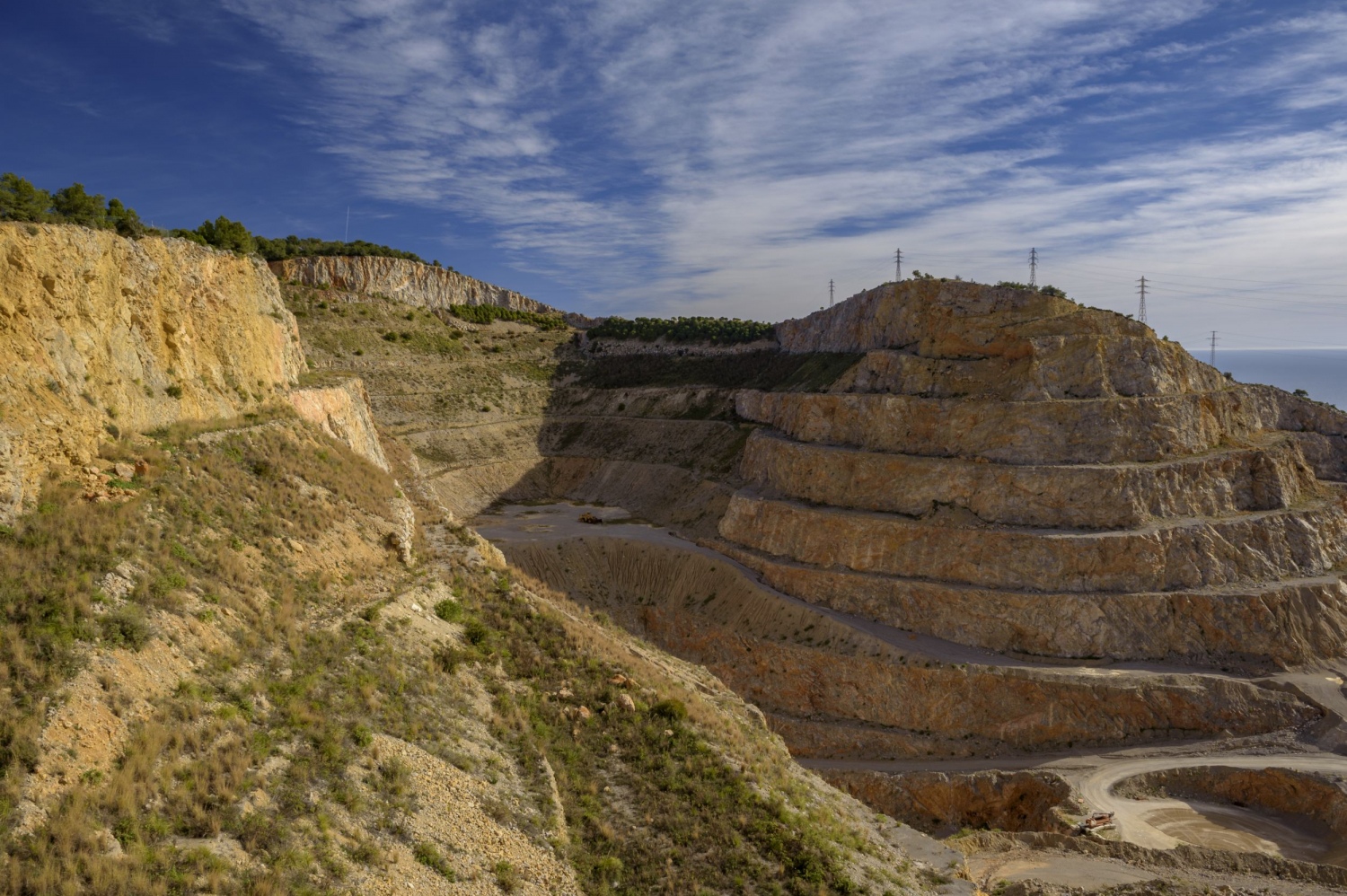
After a section of moderate ascent and several loops, the path heads north, planning until it reaches a forest track that borders a quarry from which material is still extracted. In this section of the route we will be able to see several quarries and open pit extractions, with the great visual impact and the irreparable scar that they generate in the territory. We continue bordering this quarry-gravel pit along a track that gradually climbs. From there, the sun can be pronounced in the summer months, since we will find few shades and no sources, so it is advisable to avoid the hottest hours and days.
We will pass by a kennel and enter a stretch of track through a small path that goes to the left (GR marks). This path, little trodden, allows us to save a stretch of road.
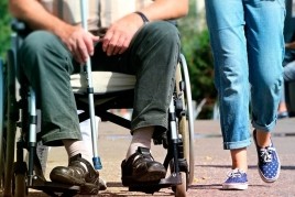
We will find the road a little further up and we will cross it. Afterwards, we will continue along a track set up as a natural park path where we will find various plants and trees marked and identified, so we can learn about the flora of the area. This section of interpretive trail is also suitable for wheelchair users.
A bit further up, the path turns 90 degrees to the left until it reaches the park house, La Pleta. From here, we have the most monotonous and heavy section of the route, since the GR runs along the paved road that goes up to the Pla de Querol or Pitxot car park.

About 2 km further up, after a stretch of ascent in full sun, we will arrive at the Pla de Querol car park. This could also be a starting point if we wanted to take a much shorter route to the top. Now we will have to follow a paved track but restricted to traffic, so it will be much more comfortable for us to walk. Above you, you will see the Vallirana radar closer and closer, the first meteorological radar of a television – meteorological service of Catalonia.
A little further up, the GR marks leave this paved track that climbs towards the Vallirana radar and we continue along a path that continues to a small pass in the area known as Campgràs. On the other side of the pass, a new perspective opens up towards Barcelona and Collserola, from a different point of view than the one we are used to seeing regularly.
We arrive next to the perimeter of the Valle de Joan landfill. Luckily, the upper part of this controlled deposit has been quite rehabilitated and is now fairly naturalized meadows.
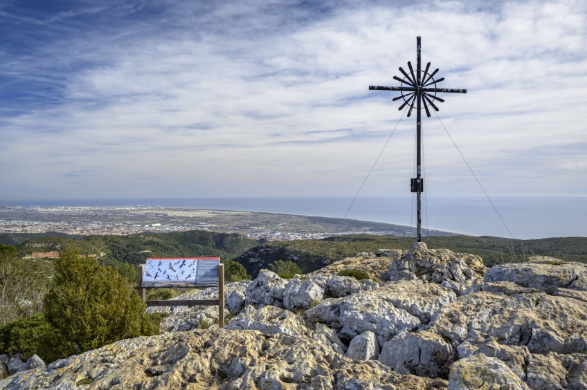
Now you only have to do the last climb to the top of La Morella, first along a dirt track and, the last 200 meters, through a path that leads to the roof of the Garraf Massif, crowned by the characteristic starry cross of the top of the Morella. From here, if the day is open, we will have very wide views, with Barcelona, Collserola and the Cordillera Litoral on one side, La Mola, Montseny and Montserrat and, beyond, the snowy Pyrenees.
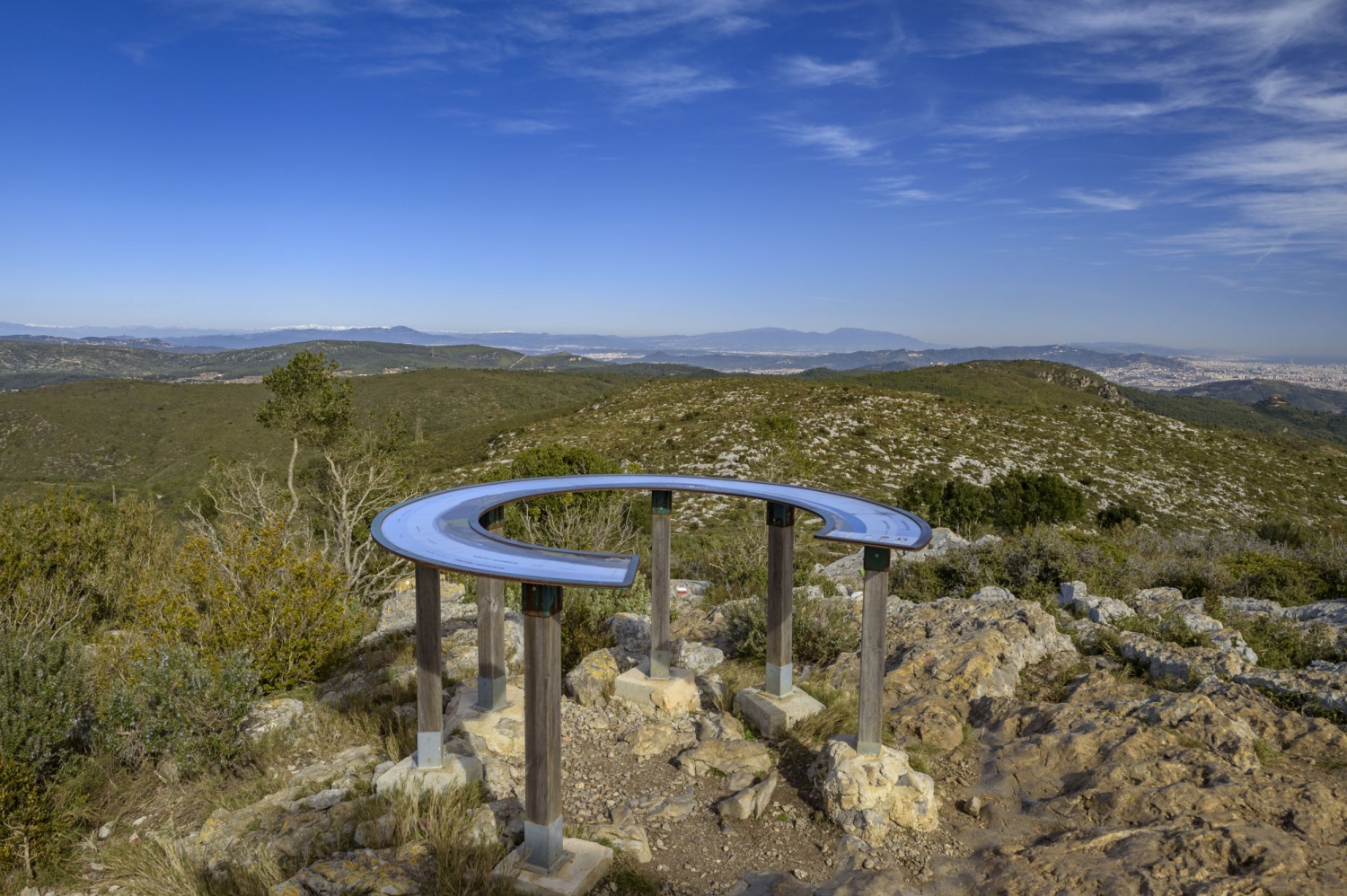
Towards the other corner, with luck, you will be able to make out the silhouette of Mallorca on the sea horizon (only on some very clean winter days). A panoramic panel will help us name the rest of the peaks and towns that can be seen from here.
To return, we will undo the path that we have made up. It will only be necessary to take a couple of detours to avoid a section of the track: the first, before the Pla de Querol car park to turn off and pass by some chasms such as the Sima de l'Asensio, which has a depth of 84m. It is hard to imagine that such a vacant lot and such a small entrance between rocks hides such a deep cavity. The reason is due to the calcareous nature of the massif. The limestone rock, soluble in water, generates what is known as karstification and causes cracks in the rock that, over thousands of years, become fissures, caves and chasms. During this stretch of the road we will see a few potholes, but the truth is that the Garraf massif is home to many more.
The other small detour that we will make is in the section past the house of the Park (La Pleta) to cover the other half of the botanical trail that we were missing and meet some other species that grow in the area. This detour will take us to the point where we cross the road in the morning. Now we will follow that short cut path that we have done in the morning until we return to the forest track that passes in front of a kennel and the quarry that we have seen on the way up. Going down, this quarry is even more surprising due to the enormous depth and gap it has excavated in the mountain.
Finally, we end up returning to the center of Garraf through the path that, winding, follows the GR-92 until in front of the Güell winery, the work of the genius Gaudí. Arrived at the beach, we will complete a summit that we have done from level 0, something unusual in the summit routes in Catalonia.
Author images and text: Sergi Boixadeu
You may also be interested in: Stroll through the natural parks

What to do
Escola de vela adaptada
Sitges (a 1.1 Km)Non-profit entity located in the Port of Aiguadolç in Sitges. Its main…
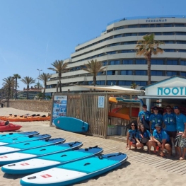
Nootka Kayak & Sup
Sitges (a 2.4 Km)Nootka Jayak & Sup offers you different activities and guided excursions so…
Where to eat
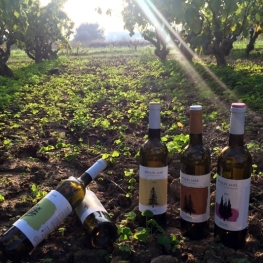
Bodega Miquel Jané
Font-rubí (a 25.1 Km)Discover the world of wine with our comprehensive viticulture and oenology courses,…
Where to sleep
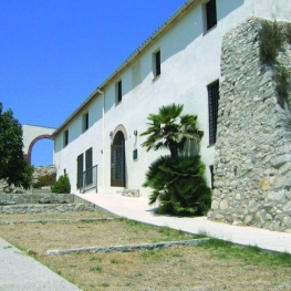

Casa de colònies Can Grau, Fundesplai
Cubelles (a 8 Km)Discover Can Grau, an old wine-growing farmhouse from the 16th century. XIV…
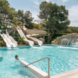
Garrofer Green Camping
Sitges (a 2.6 Km)Come to Garrofer Green Camping and enjoy a unique vacation in a…
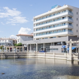
Hotel Balneari Platja de Comarruga
El Vendrell (a 24.9 Km)Spectacular resort located near the sea to enjoy the marine environment and…
Alberg Centre Esplai, Fundesplai
El Prat de Llobregat (a 24.2 Km)Discover the Centro Esplai hostel, in the municipality of El Prat de…