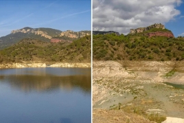
If anything has characterized the years 2022 and 2023 in Catalonia, it has been the persistent and serious drought that, so far, is behaving more intensely and more extreme than that of 2005-2008, although…
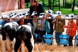
To start the month in the best way, La Fageda and femturisme.cat have joined forces to raffle 6 double tickets to visit the La Fageda facilities. A guide will accompany you on a walk through the farm…
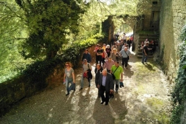
Cubells celebrates one more year the traditional Pilgrimage to the Virgin of Salgar! The festivity begins with the traditional walk that is celebrated annually for Sant Marc's day, going from Cubells…
The't Culture Program starts from February to June in Alcarràs! We present the new culture programming for the season from February to June 2024 in Alcarràs with a selection of shows from…