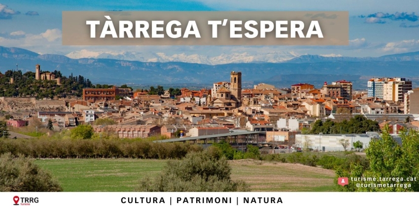
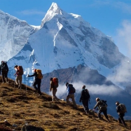
The route of the 3 mountains
The route of the 3 mountains is a journey that takes place on trails that hide Montseny natural parks, and Sant Llorenç del Munt and Montserrat Obac. Hence the reason for its name.
This itinerary is a trip to the Catalan littoral which discloses three of the most iconic mountain ranges of our country delving deeper into their more obscure corners.
The route begins in the Montseny Natural Park, a natural area which by its nature was declared a Biosphere Reserve in 1978 by UNESCO and is an example of the Mediterranean landscapes that are located in the vicinity of the area influence of large cities, as it is located just 45 minutes from Barcelona .
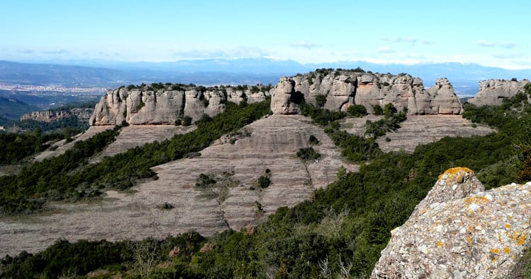
The route continues to the Park and Sant Llorenç del Munt Obac where the landscape is more abrupt and where the cliffs and monoliths of red conglomerate predominate. It ends in the singular mountain of Montserrat, one of the cultural symbols, and spiritual, of Catalonia, categorized as an area of natural interest.
This route, as well as offering the possibility of hiking, has a high historical and cultural component, as these mountains have Romanesque chapels, monasteries, modernist buildings ... and other architectural samples.
A route that, despite being somewhat technical, caters for all hikers, have better or worse fitness.
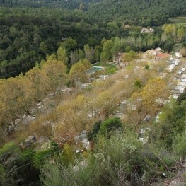
Route's villages
The start of the route
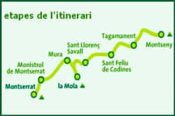 The route of the 3 mountains occurs in six different stages that are drawn following the signs of the GR-5 and the own route along the 106 kilometers from extending.
It is recommended to do it in six days, one stage per day, being able to go on a journey from 3.5 miles to 24, depending on the nature and definition of each of the stages.
The first stage begins in the village of Montseny and ends in the town of Tagamanent outlining a journey of 22 km and becoming one of the longest stages passing through the southwest side of the Montseny massif.
This first leg of the route of the 3 mountains takes us through places with oak forest brings us to the banks of river Tordera.
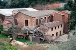
 Along the tour we will also journey through history witnessing old mills, past the Romanesque chapel of San Martí Montseny and enjoying the silence near the remains of an old inn or tavern in 1890 or so.
This section is fairly flat, although from the farmhouse and the source of Vilar becomes a narrow path and steep climb towards the pla Café, which offers us a splendid view of the Cerro de l'Home, the Agudes and Matagalls.
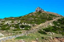
It at this point pla la Calma is crossed to go down a path up to the hill Tagamanent from afar and can be recognized by the silhouette of the old church.
At the foot of this hill is an information and Ethnological Park Tagamanent.
Stage 2 and 3: De Sant Llorenç Savall Tagamanent
From the town of Tagamanent , close to river and rail Congost Shaft Barcelona - Vic - Puigcerdà , the next stage begins.
 The second stage extends for 18 miles linking Tagamanent with Sant Feliu de Codines through Figaró and Sant Miquel del Fai.'s third stage, with a distance 14 kilometers, ending at Sant Llorenç Savall .
At the beginning of Step 2 continues the Congost river to get to the core of Figaro where the road goes into a wild landscape that hides the Sot del Bac.
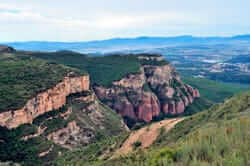
Other scenically spectacular surprises in store for us toward the cliffs rise of Bertí where we enjoy a panoramic view from the top of Puigfred formed bluffs, cliffs and ravines.
This section defines a geographically very well used paths, since it uses the topographic terraces of small mountains and hills in the area. It passes through the collet of Pereres and colloet of Feu, among others.
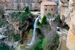 The second stage also accompanied us to the historic landmark site of Sant Miquel del Fai.
The third stage, realizable in approximately 3.5 hours, starts from Sant Feliu de Codines where unlinked to the second stage, the area known as the Terme Creu. This stage also presents a particular landscape where forests predominate deep white pine combine with spaces for solitude, rest and reflection.
Not much farther from the beginning of this section, walking beside the stream of Can Deu, we can enjoy a seasonal pool of water called the Gorg Negre.
Along the route we also find the lonely Romanesque hermitage of Mare de Deu del Grau, we should be on a lone rock on top of which the castle and the Ecological Sanctuary is Gallifa and enjoy vast landscapes of forests they scored us the address Caldes de Montbui .
The descent Castle Gallifa seems complicated by its proximity to a ravine but a very well equipped with handles stretch. Once down the route continues along dirt tracks and paths towards Sant Llorenç Savall Penjallops crossing the collet of the pla de Creus and place them in their Avenques, among others.
Step 4 and 5: 48 km necks, pine forests and lonely and surprising places
The fourth stage joins Sant Llorenç Savall with Mura on a journey of 24 km and is estimated to be performed at 7.25 hours. Conducted across emblematic and characteristic of the Catalan coast landscapes such as Mola and Montcau.
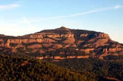 The fourth tranche rises foot of the mountain of Sant Llorenç del Munt, up the collet of Llor (778 m) and crown collet d'Eres (942 m) to reach the top of the Mola (1,107 m).
However, the climb to the Mola is an anecdotal and leisure to enjoy views of Eagle Plain Vallés, because after you go back to get back to the collet d'you to get back on track in the direction of travel collet d'Estenalles that brings us to Montcau.
In this pueto is the Interpretation Center of the Natural Park of Sant Llorenç del Munt and Obac.
Finally, walking along a forest track and following the GR-5 signaling is passed by in Boix and coll descent to Mura .
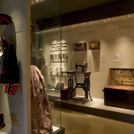
In Mura is also an Interpretation Centre which gives us to see the rural life in these three mountain ranges emphasis, especially in the use of natural resources in this environment.
Stage 5, which starts from this town, leads us to Monistrol Montserrat by a path, also 24 miles, but that can be covered in 6.5 hours.
 The path way to the Puig de la Balma, takes us to a beautiful area known as the Cross of the Vila.
This way we will continue towards Rellinars enjoying quiet places and immersed in Mediterranean pine woods lonely and lapsing the collet Roig, the apex of Andreu Puig, Coll de la Creu dels Alls and coll of Morella.
The route between Rellinars and Monistrol of Montserrat , which coincides with the GR-5, reveals a hidden and fantastic place, meander Castellbell the Llobregat river. To make it even more surprising arrival at Monistrol , it is dazzled by the iconic Montserrat mountain.
Montserrat monistrol also houses the Visitor Centre and Tourist care about 3 Montes information and an exhibition space for the route.
Step 6: the denouement in the monastery of Montserrat
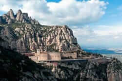 The last stage of the route of the 3 mountains is the shortest of all, with a distance of 3.5 km, but continuous ascent too steep times.
However, it is the most awaited and admired by the imposing presence of Montserrat and its rise, where breathtaking mountain towering over our heads.
The route continues to follow the signposted GR-5, except for a small section that follows for its variant GR-96, 1.5 miles after leaving the Monistrol until spot located between the hill Mullapans and Pla de les Bruixes.
During the ascent you walk near the railway line mountain between Monistrol and the Monastery of Montserrat, and passed near the cable car stations Montserrat and funiculars of Sant Joan and Santa Cova to the heart of Catalonia, the Montserrat mountain.
You may also be interested in: Stroll through the natural parks | Reconnecting with Barcelona is much more

What to do
Museu Arxiu Tomàs Balvey
Cardedeu (a 11.5 Km)The MATBC houses the collection of its creator, Tomàs Balvey y Bas…

Balneari Termes Victòria
Caldes de Montbui (a 6.2 Km)At the Balneario Termes Victoria Hotel we want you to feel at…
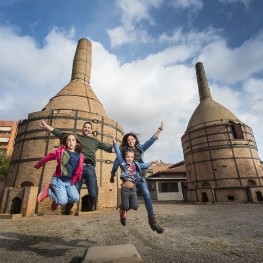
Xarxa de Turisme Industrial
(a 11.2 Km)Enter a Catalonia that you can not imagine. A place where to…
Guies Arania - Guies de muntanya i barrancs
Balenyà (a 9.1 Km)A small adventure sports company specialized in canyoning, via ferrata, snowshoe routes,…
Where to eat
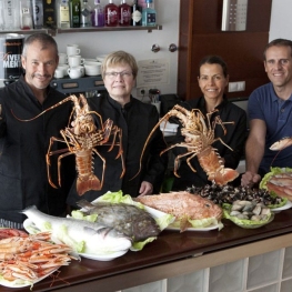
Restaurant Marisquer Can Ladis
Sant Fruitós de Bages (a 10.2 Km)The commitment of an entire family since 1988 working for our customers,…
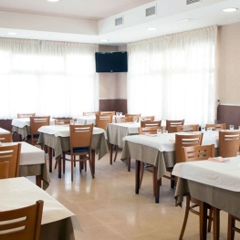
Cal Pau Xic
Subirats (a 21.8 Km)A restaurant lifetime. Catalan cuisine, home like before. Our goal is to…
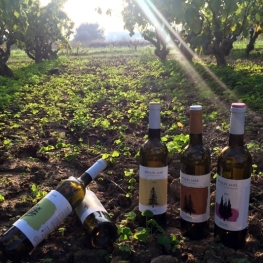
Bodega Miquel Jané
Font-rubí (a 26.6 Km)Discover the world of wine in our complete viticulture and oenology courses,…
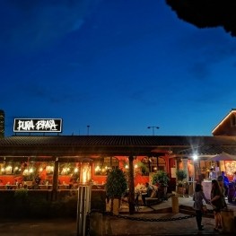
Pura Brasa
Pineda de Mar (a 28.6 Km)A unique gastronomic experience: Pura Brasa is a close and fun concept…
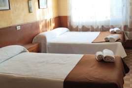
Where to sleep
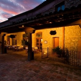
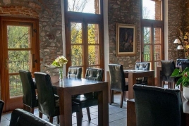
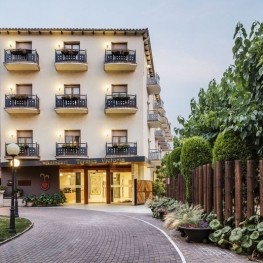
Hotel Molí de la Torre
Bigues i Riells del Fai (a 3.7 Km)12 double rooms and a junior Suite, a meeting room, ideal for…
Balneari Termes Victòria
Caldes de Montbui (a 6.2 Km)At the Balneario Termes Victoria Hotel we want you to feel at…
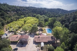
Càmping l'Illa
Sant Quirze Safaja (a 3.7 Km)In the countryside, in the middle of the mountain at 600 m…
Hotel Blancafort Spa Termal
La Garriga (a 4.6 Km)Come to the Hotel Blancafort Thermal Spa and disconnect in the quiet…